Introducing the Lower Connecticut River Valley Trail
|
|
|
- Adam Roberts
- 6 years ago
- Views:
Transcription


1 Introducing the Lower Connecticut River Valley Trail 1
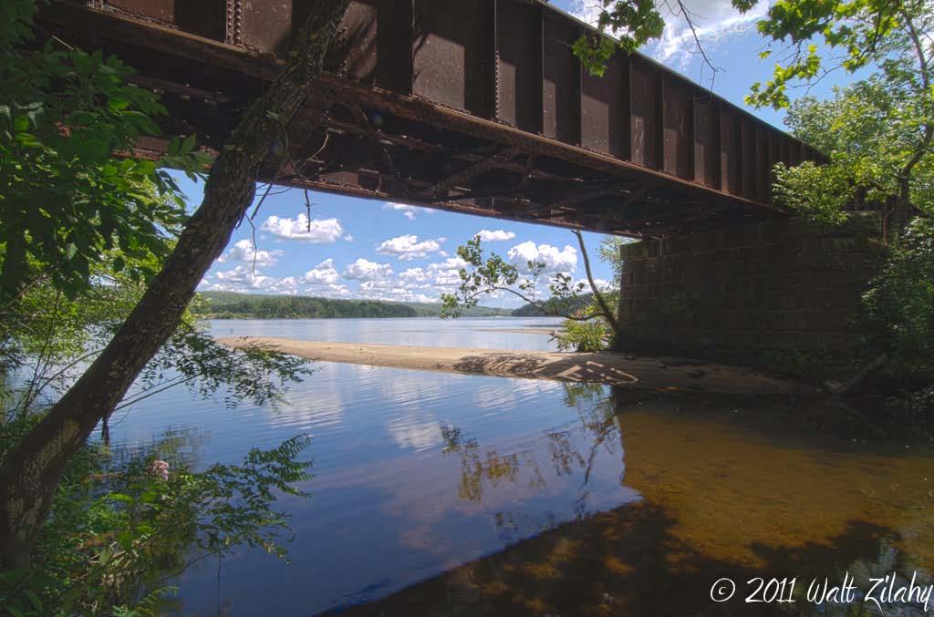
2 2
3 Purpose of Today s Presentation To introduce you to an important opportunity to protect some of the most valuable property in the Lower CT River Valley Region. To seek your support and endorsement of an unique Rails-to-Trails project that will make miles of CT River shoreline accessible to the public. 3
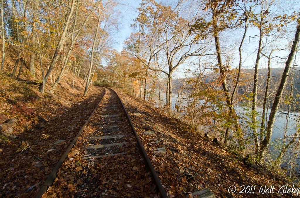
4 4
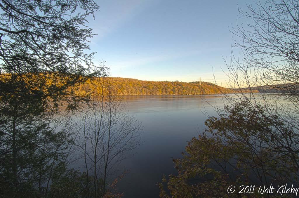
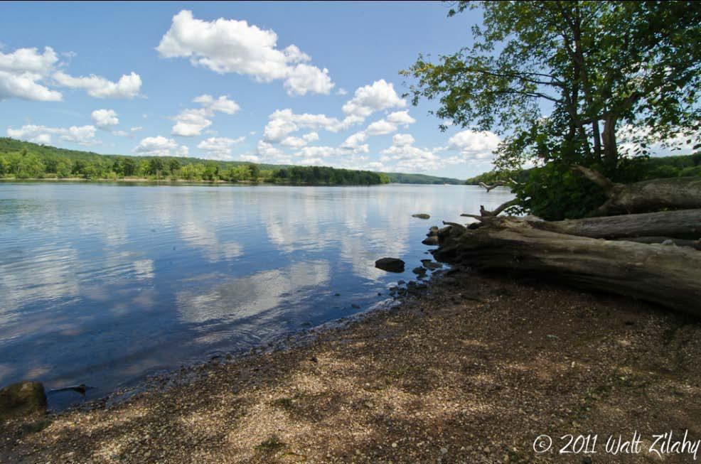
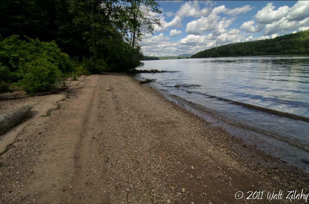
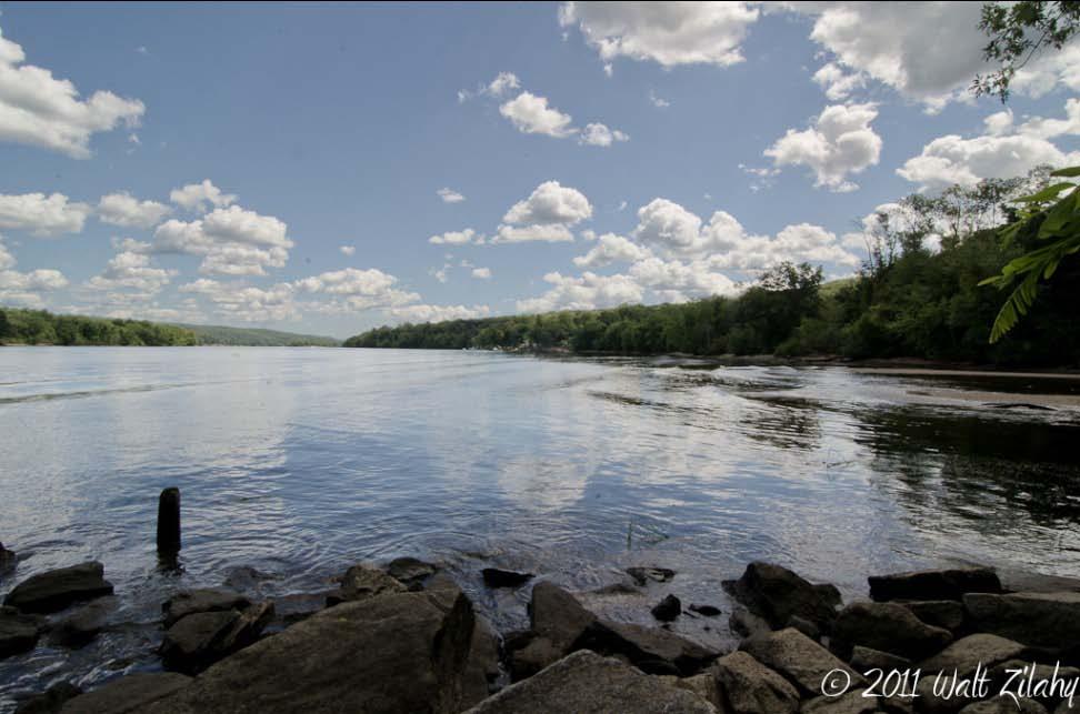
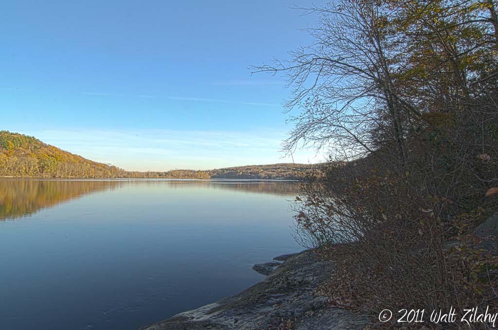
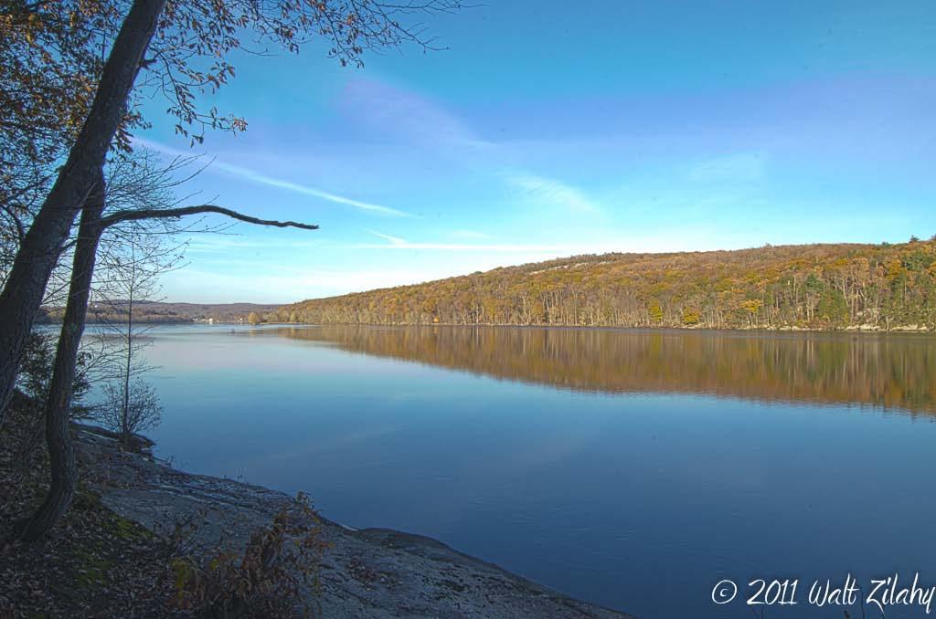
5 The Lower Connecticut River Is the most important natural resource asset in this region Is recognized as One of the last great places on earth Is the source of our region s eco-tourist-recreation economy Is inaccessible to the public seeking to enjoy its beauty 5
6 6
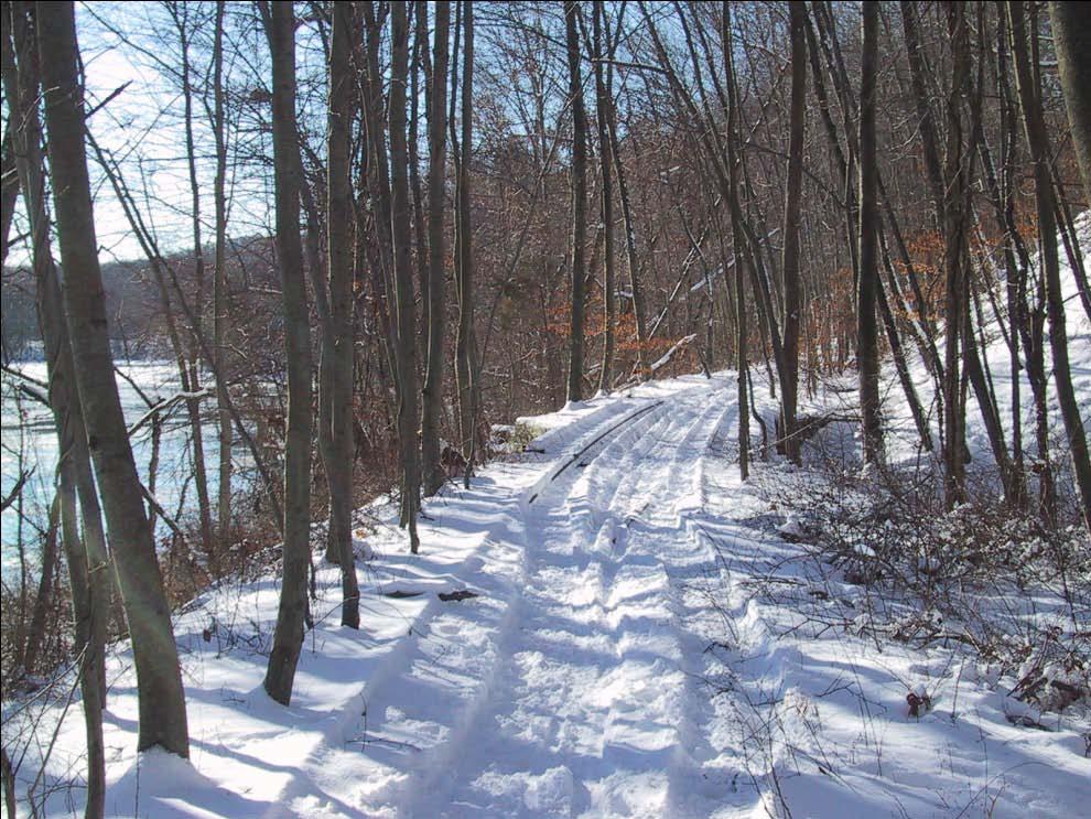
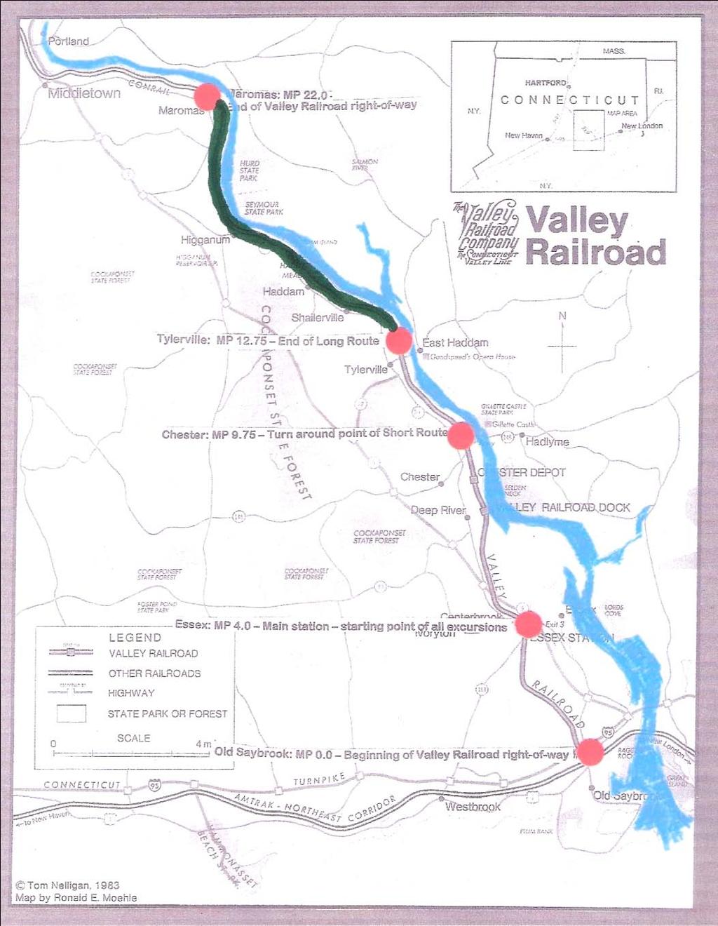
7 The Vision * To participate in the federal government s America s Great Outdoors (AGO) program, which calls for the creation of a National Blueway along the entire 410 mile length of the CT River allowing more people to enjoy access to the river for recreational purposes. To be accomplished in part by transforming the now unused 100-acre northern portion of the CT River Valley State Park into a multi-purpose trail extending almost 10-miles from Eagle Landing State Park in Tylerville (Haddam) to Maromas (Middletown) and represent the only significant trail directly along the Lower CT River shoreline. To become an important segment of the CT River Heritage Trail, an ambitious project connecting waterfront trails along the CT River from the L.I. Sound to the Canadian border. 7

8 Beaver Dam 8
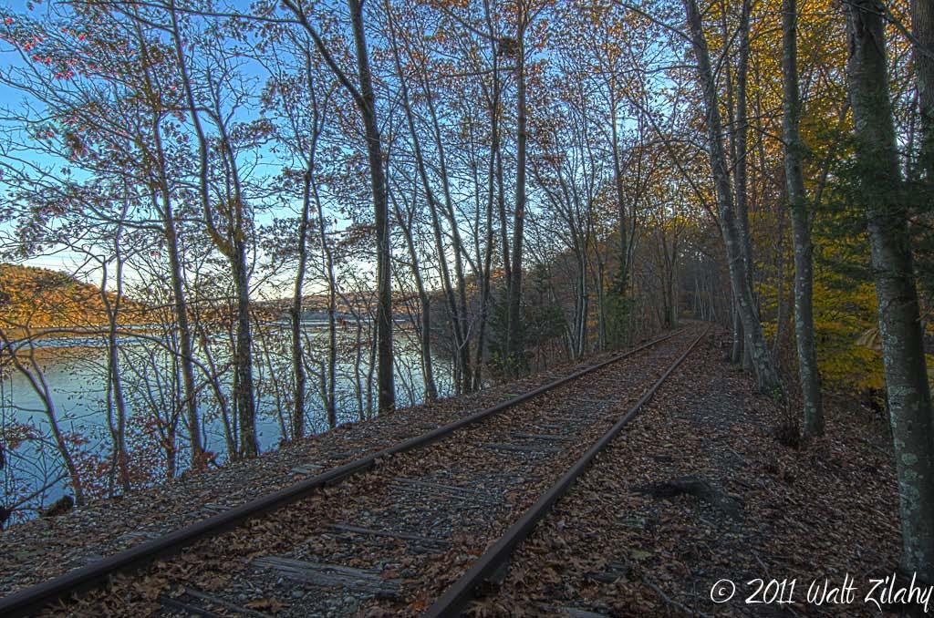
9 The Current Situation The CT Valley Railroad State Park was acquired by the state in The property consists of a 300-acre, 22-mile abandoned railroad right of way running from Old Saybrook to Middletown along the Connecticut River. The purchase was made possible by a 50% grant by the Federal Bureau of the Interior (National Park Service) from the Land and Water Conservation Fund Act. This funding requires that the land be used for public outdoor recreation in perpetuity. The Valley Railroad Company has been leasing the entire park from the State since 1970 and has been operating the Essex Steam Train as far north as Tylerville. 9
10 10
11 The Current Situation The 9.25-miles of track between Tylerville and Middletown is non-operational, in derelict condition, and has never been used by the VRC over the 42 years of its lease. Despite that, CTDEEP requires the railroad to spray dangerous herbicidal chemicals such as Diuron for weed control on the right of way, which in many places is just a few feet away from the CT River. In 2009 and 2010 the state made serious attempts to restore the unused right of way as a freight rail corridor. Failing to obtain federal funding and retreating due to public outcry, ConnDOT has removed the park from its rail plan but strongly supports maintaining the park as a rail corridor and opposes conversion to a trail. 11
12 12

13 The Current Situation Even one freight train per week would shut down all the recreational activity in the park because of strict federal NO TRESPASSING requirements. The riverfront would become inaccessible to hikers, fishermen, kayakers, etc. Under the Land and Water Conservation Fund Act, to restore freight service, the state would have to convert the entire 300-acre parcel by substituting land of at least equal fair market value and of reasonably equivalent usefulness and location. 13
14 14
15 Instead of No Trespassing signs, chemical spraying, and the impossible financial and practical burden of finding a suitable replacement property so that an unneeded freight train line can spoil the serenity and beauty of the Lower Connecticut River Valley region, how about this as an alternative? 15
16 16
17 The Dream Creating a one-of-kind trail along the CT River The state should officially railbank the unused northern portion of the park to preserve the corridor for the possibility of future rail service should the need someday be demonstrated. Until that unlikely day occurs Create a one-of-a-kind trail providing hiking, biking, equestrian, and skiing opportunities through the state park. This would enable the public to significantly increase their outdoor recreational activities in this area and enjoy some of the most beautiful riverfront in the country. In addition to recreational activities, the trail could be used by bicycle commuters, especially by linking with CREPA s goal of rails with trails to the south and Connecticut River Heritage Trails to the north. This trail will attract both state residents and tourists to the River Valley and will boost tourism based businesses in the area including the Essex Steam Train. 17
18 18
19 Now is a Perfect Time to Make it Happen This is what the US Dept of the Interior says about AGO: It is a call for a grassroots approach to protecting our lands and waters and connecting all Americans to their natural and cultural heritage. To empower all Americans to share in the responsibility to conserve, restore, and provide better access to our lands and waters in order to leave a healthy, vibrant outdoor legacy for generations yet to come. Devote a portion of federal LWCF funds on projects that promote large scale land conservation, enhance urban parks and community green spaces, and improve river restoration and access. 19
20 20
 Connecticut")

21 You Can Help by Sending a Letter like this to Commissioner Esty at ConnDEEP Your Letterhead Daniel C. Esty Commissioner Connecticut Department of Energy and Environmental Protection 79 Elm Street Hartford, CT We, the, support the goals of the America s Great Outdoors (AGO) Connecticut River Blueway program to provide more trails and access points for water-based recreation along the river. We urge you to include the northernmost 9.25 miles of the Connecticut Valley Railroad State Park in the Blueway program. A multi-purpose riverfront trail from Tylerville (Haddam) to Maromas (Middletown) will greatly enhance outdoor recreational opportunities and access by the public to this part of the beautiful Connecticut River, an area called by the Nature Conservancy one of the last great places on earth. Signed 21

22 Thank you for taking the time to watch this presentation. We hope you will work with us to make the Lower CT River Valley Trail a reality. 22
DRAFT - APRIL 13, 2007 ROUTING STUDY FOR TRAIL CONNECTIONS BETWEEN CALAIS AND AYERS JUNCTION
 DRAFT - APRIL 13, 2007 ROUTING STUDY FOR TRAIL CONNECTIONS BETWEEN CALAIS AND AYERS JUNCTION Abstract The vision for the East Coast Greenway is an off-road urban trail system running from Calais, Maine
Blue Trails: Protecting Rivers, Fostering Stewardship
 Blue Trails: Protecting Rivers, Fostering Stewardship What Are Blue Trails? Blue Trails are the water equivalent of hiking trails. They are created to facilitate recreation in and along rivers and water
The following trails completed their work utilizing funds awarded by the Greenways Foundation:
 The Greenways Foundation Grant Awards 2013 and 2014 Our grant program has been in place since 2012 and is funded entirely by the proceeds received through our Indiana BMV specialty license plate. Please
Chapter 6: POLICY AND PROCEDURE RECOMMENDATIONS
 Chapter 6 POLICY AND PROCEDURE RECOMMENDATIONS FOR SRRA Below are seven policy elements that should be considered for adoption by the Southwest Regional Recreation Authority of Virginia: 1. Develop strategies
Map 1.1 Wenatchee Watershed Land Ownership
 Map 1.1 Wenatchee Watershed Land Ownership Map 1.1 Wenatchee Watershed Land Ownership The Wenatchee watershed lies in the heart of Washington state in Chelan County. Just larger than the state of Rhode
Cascade River State Park Management Plan Amendment
 This document is made available electronically by the Minnesota Legislative Reference Library as part of an ongoing digital archiving project. http://www.leg.state.mn.us/lrl/lrl.asp Cascade River State
CHAPTER ONE LITERATURE REVIEW
 CHAPTER ONE LITERATURE REVIEW LITERATURE REVIEW This chapter summarizes the most recently published community impact studies and articles that relate to multiuse trails. The review focuses on publications
A CASE FOR COMPLETING THE JORDAN RIVER PARKWAY: A
 A CASE FOR COMPLETING THE JORDAN RIVER PARKWAY: A safe crossing at 9000 South and 850 West Proposed 9000 South Underpass Parkway Timeline Parkway, Trail, and Tourism Facts Blueprint Jordan River 1971 1973
CHAPTER 4 -- THE LAND USE PLAN: DESCRIPTIONS AND POLICIES FOR THIRTEEN PLANNING AREAS
 CHAPTER 4 -- THE LAND USE PLAN: DESCRIPTIONS AND POLICIES FOR THIRTEEN PLANNING AREAS NORTH CENTRAL CAC AREA LITTLE VALLEY ROAD TO JUG HANDLE CREEK PLANNING AREA This planning area includes Cleone, Noyo,
$866,000. $1,400,000 Health Benefits $13,156,000 TOTAL ANNUAL DIRECT BENEFITS. $10,890,000 Economic Benefits
 SINGING RIVER TRAIL Trails Create Value + Generate Economic Activity Trails generate economic returns through improved health, safety, and environmental conditions, raise property values, and attract visitors.
2016 Regional Transportation Alternatives Program (TAP) Grant Application
 Grant Application") 2016 Regional Transportation Alternatives Program (TAP) Grant Application PROJECT TITLE: Yelm-Tenino Trail Extension Feasibility Study TRPC use only GENERAL PROJECT INFORMATION Agency or Organization City
2016 Regional Transportation Alternatives Program (TAP) Grant Application PROJECT TITLE: Yelm-Tenino Trail Extension Feasibility Study TRPC use only GENERAL PROJECT INFORMATION Agency or Organization City
4.0 OUTDOOR RECREATION 4.1 PUBLIC LANDS
 4.0 OUTDOOR RECREATION 4.1 PUBLIC LANDS Public lands provide a wide range of recreational opportunities and are considered a valuable community asset. There may be seasonal and/or other use restrictions
Draft Western District Plan
 Powered by TCPDF (www.tcpdf.org) Draft Western District Plan Submission_id: 31732 Date of Lodgment: 15 Dec 2017 Origin of Submission: Online Organisation name: APP Corporation Pty Ltd Organisation type:
Blueways: Rivers, lakes, or streams with public access for recreation that includes fishing, nature observation, and opportunities for boating.
 Parks, Open Space and Trails PRINCE WILLIAM COUNTY 2008 COMPREHENSIVE PLAN TRAILS PLAN CONTENTS The components of the trails plan are: Intent Definitions Goals, Policies, and Action Strategies Trails Map
FAQ: HR 799 & S. 403: North Country National Scenic Trail Route Adjustment Act
 FAQ: HR 799 & S. 403: North Country National Scenic Trail Route Adjustment Act Exactly what does HR 799/S. 403 call for? These bills simply amend the National Trails System Act (16 U.S.C. 1244(a)(8)) by:
Rivanna Trails Foundation
 a project of the Rivanna Trails Foundation Source www.rivanna.avenue.org Who we are The mission of the Rivanna Trails Foundation (RTF) is to create, promote the creation of, and protect footpaths, trails
CHAPTER III: TRAIL DESIGN STANDARDS, SPECIFICATIONS & PERMITS
 CHAPTER III Trail Design Standards, Specifications & Permits This chapter discusses trail standards, preferred surface types for different activities, permits, and other requirements one must consider
The Triple Divide Trail System: Building an Eco-Tourism Corridor as a Strategy for River Conservation
 The Triple Divide Trail System: Building an Eco-Tourism Corridor as a Strategy for River Conservation William Hart, President Genesee River Wilds, Belmont, NY in collaboration with Allen Kerkeslager, Saint
Strategic Plan. Manassas Battlefield Trust
 Manassas Battlefield Trust m Strategic Plan 2018-2020 M a n a s s a s B a t t l e f i e l d T r u s t, 1 2 5 2 1 L e e H i g h w a y, M a n a s s a s, V A 2 0 1 0 9 Manassas Battlefield Trust Manassas,
APPENDIX OFFICIAL MAP ORDINANCE OF HAMILTONBAN TOWNSHIP OFFICIAL MAP NARRATIVE
 APPENDIX A OFFICIAL MAP ORDINANCE OF HAMILTONBAN TOWNSHIP OFFICIAL MAP NARRATIVE INTRODUCTION: The Official Map of Hamiltonban Township has been prepared to identify those lands and features that Hamiltonban
SOUTH INTERCHANGE AREA
 Santaquin City General Plan 1 Location and Characteristics The South Interchange Area of Santaquin is located west of Interstate 15 and south of 500 South (Figure 1). It includes properties already annexed
To the Public: President The Atchison, Topeka & Santa Fe Railway Co. V I
 V I To the Public: On October 25, 1960, the Santa Fe Railway Co. filed an application with the Interstate Commerce Commission for permission to acquire control of the Western Pacific Railroad. Because
13.1 REGIONAL TOURISM ISSUES AND SUMMARY OF FINDINGS
 13 REGIONAL TOURISM T he County of Mariposa s recreation needs and facilities fall within two categories: regional tourism and local recreation. This Element focuses on regional tourism issues related
BROCHURE. APPLE HILL WOODS 118 +/- Acres Camino, California. Presented by Jim Copeland
 BROCHURE APPLE HILL WOODS 118 +/- Acres Camino, California Presented by Jim Copeland 1 The Property This 118 acre is a rare gem in the Sierra Nevada foothills. Covered with lush forestland and scattered
MASTER PLAN EXECUTIVE SUMMARY
 Biscuit Run State Park Scottsville Road (State Route 20) Charlottesville, VA 22902 Biscuit Run State Park MASTER PLAN EXECUTIVE SUMMARY Department of Conservation and Recreation Division of Planning and
Kit Carson-Challenger Ridge Trail Project Annual Performance Report-2014 October 22, 2014
 1 Kit Carson-Challenger Ridge Trail Project Annual Performance Report-2014 October 22, 2014 Willow Lake and Kit Carson Peak 2 SUMMARY The Rocky Mountain Field Institute began Phase 1 of a multi-phase,
Teton Pass Centennial Trail Project Area Map
 33 Victor Pioneer Park Teton Pass Centennial Trail Project Area Map Legend Existing Pathway or Shared Road Proposed Shared Use Pathway Proposed Trail 33 Game Creek Trailhead - Forest Access Road / Highway
Miner & Silverstein Appraisal Company Division of Miner & Silverstein, LLP
 Miner & Silverstein Appraisal Company Division of Miner & Silverstein, LLP Marina Market Analysis Upper Connecticut River Marina Market Study Winter 2005-2006 The following presents a winter 2005-06 market
OPENING UP SOUTH AUSTRALIA S RESERVOIRS PUBLIC ACCESS FOR RECREATION
 OPENING UP SOUTH AUSTRALIA S RESERVOIRS 2036 WILL MARK OUR STATE S BICENTENARY By the time our State turns 200 years old, I want South Australia to be a place of prosperity. Planning and delivering on
NAVAJO COMMUNITY PLAN
 NAVAJO COMMUNITY PLAN Prepared by the NAVAJO COMMUNITY PLANNERS and THE CITY OF SAN DIEGO City of San Diego Planning Department 202 C Street, MS 4A San Diego, CA 92101 Printed on recycled paper. This information,
Trails. Lois Jensen Nature Preserve is a 30 acre parcel on the north end of the city. It provides unspoiled wooded paths.
 Trails Lois Jensen Nature Preserve is a 30 acre parcel on the north end of the city. It provides unspoiled wooded paths. TRAIL S, PATHS, ROUTES AND CONNECTORS Citizen input pointed to trails, paths, bike
The Chu property is a 6.57 acre parcel located in the Town of Superior on the west side of McCaslin Boulevard. In 2014, the Town of Superior acquired
 1 The Chu property is a 6.57 acre parcel located in the Town of Superior on the west side of McCaslin Boulevard. In 2014, the Town of Superior acquired the Chu property for open space with a contribution
Restore and implement protected status that is equivalent, or better than what was lost during the mid-1990 s
 THE ROSSLAND RANGE, OLD GLORY AREA. Executive summary. The Friends of the Rossland Range Society, on behalf of the local outdoor community, seeks to accomplish the following with respect to the Old Glory
Economic Development and Tourism
 SECTION 4 SECTION 4 Economic Development and Tourism 4. Economic Development and Tourism Tourism plays a very important role in Niagara s economy, providing employment and generating business for support
To: Cam Hooley From: Trails 2000 Date: September 30, 2016 Re: Hermosa Comments. Dear Cam:
 ! To: Cam Hooley From: Trails 2000 Date: September 30, 2016 Re: Hermosa Comments Dear Cam: Trails 2000 is commenting on the Forest Service Management Plan for the Hermosa Creek Watershed Management Plan
Historic Highway Advisory Committee To Meet in The Dalles
 In This Issue Get Involved Highway Gets Major Endorsement New Life for the Old Road Bike Pods and Hubs Time Travel on the Historic Highway Gorge Ride 2014 The Historic Columbia River Highway News is your
Thank you for this third opportunity to comment on the proposed revisions to the Coconino National Forest Management plan.
 March 19, 2014 Flagstaff Biking Organization PO Box 23851 Flagstaff, AZ 86002 Vern Keller Coconino National Forest Attn: Plan Revision 1824 South Thompson Street Flagstaff, Arizona 86001 coconino_national_forest_plan_revision_team@fs.fed.us
City of Haslett. City of East Lansing. City of East Lansing
 Central Park North (Nancy L. Moore Park) Lake Park North Expansion White Park Expansion #2 White Park Expansion #1 County East East Haslett East East TF87-212 Acquisition $90,000.00 Park. TF08-138 Acquisition
New England National Scenic Trail. Land and Water Conservation Fund FY2014 Request
 New England National Scenic Trail Land and Water Conservation Fund FY2014 Request National Trails System Land and Water Conservation Fund FY2014 New England National Scenic Trail Tanager Hill Penwood State
RELATED SANTA CLARA SANTA CLARA, CALIFORNIA. RELATED SANTA CLARA Santa Clara, CA
 RELATED SANTA CLARA SANTA CLARA, CALIFORNIA RELATED SANTA CLARA Santa Clara, CA JUNE 2016 APPROVAL TIMELINE RELATED SANTA CLARA Santa Clara, CA 1 ACRES PARKS & OPEN SPACE (40% OF TOTAL SITE) PARCEL 3 PARK
Partners: Michigan California Timber Company Shasta-Trinity National Forest Pacific Crest Trail Association The Trust for Public Land
 Partners: Michigan California Timber Company Shasta-Trinity National Forest Pacific Crest Trail Association The Trust for Public Land Describe the project location, size, opportunities, and timing. Provide
Georgetown-Lewes Rail/Trail Study. Rail/Trail Study: Cool Spring to Cape Henlopen State Park New Road Extension (House Resolution No.
 Georgetown-Lewes Rail/Trail Study Rail/Trail Study: Cool Spring to Cape Henlopen State Park New Road Extension (House Resolution No. 47) August 22, 2011 Presentation Outline Background Benefits Statewide
YUKON TOURISM DEVELOPMENT STRATEGY GROWING TOURISM. OUR FUTURE. OUR PATH.
 YUKON TOURISM DEVELOPMENT STRATEGY GROWING TOURISM. OUR FUTURE. OUR PATH. Tourism in Yukon WHAT DOES TOURISM CONTRIBUTE TO THE YUKON ECONOMY? Tourism is a major contributor to the local economy, responsible
Naugatuck River Greenway Steering Committee
 This letter is being submitted in strong support of the City of Ansonia s application to the Department of Energy and Environmental Protection Recreational Trails Program for the funding to conduct a routing
Waterfront and Marina Strategic Plan. May 26, 2015 Infrastructure, Investment & Development Committee
 Waterfront and Marina Strategic Plan May 26, 2015 Infrastructure, Investment & Development Committee 1 Purpose Background Update work completed or underway Vision & principles Balanced plan with opportunities
Classifications, Inventory and Level of Service
 Classifications, Inventory and Level of Service Section 3 Kenmore Park, Recreation and Open Space Plan 1 P a g e Classifications and Inventory Park Classifications Kenmore classifies its parks based upon
ROYAL GORGE PARK and RECREATION AREA. A Feat of Natural and Man-Made Engineering
 ROYAL GORGE PARK and RECREATION AREA A Feat of Natural and Man-Made Engineering As Growth Resumed in the 1870 s Town Leaders Began to Envision a Tourist Industry. The Arkansas River Canyon was advertised
4.19 Parks, Recreation, and Conservation Lands
 interchange would have on the Reed Paige Clark Homestead located on the north side of Stonehenge Road. Alternative D would also affect Palmer Homestead, E.F. Adams House, and Knapp Brothers Shoe Manufacturing
ANAGEMENT. LAN November, 1996
 M ANAGEMENT P LAN November, 1996 for Coldwater River Provincial Park Ministry of Environment, Lands and Parks BC Parks Department Coldwater River Provincial Park M ANAGEMENT P LAN Prepared by BC Parks
GLENTHORNE NATIONAL PARK OUR NEW BACKYARD
 2036 WILL MARK OUR STATE S BICENTENARY By the time our State turns 200 years old, I want South Australia to be a place of prosperity. Planning and delivering on my vision for a better future starts now.
ADVENTURE PLAN EXPLORE PARK
 ADVENTURE PLAN ROANOKE COUNTY S EXPLORE PARK ROANOKE COUNTY PARKS, RECREATION AND TOURISM 1206 KESSLER MILL RD SALEM, VA 24153 (540) 387-6078 WHAT S INCLUDED? Explore Park Adventure Plan - Guided by extensive
Bike Trails By Rail In The Stour Valley: Circular Rides Around Ashford And The Garden Of England By Nicki Barron;Stephen Bourner
 Bike Trails By Rail In The Stour Valley: Circular Rides Around Ashford And The Garden Of England By Nicki Barron;Stephen Bourner If you are searched for a book Bike Trails by Rail in the Stour Valley:
City Council Workshop July 26, 2010
 Des Moines Trails Connecting a Community City Council Workshop July 26, 2010 1 OVERVIEW Trail Benefits Trails Progress How We Fund Trails What s Next for Trails 2 What is a trail? Paved Trails 10 wide
PO Box 257 PO Box 257 PARRAMATTA NSW 2124 PARRAMATTA NSW 2124
 31 March 2017 Sean O Toole Sheridan Dudley District Commissioner - West District Commissioner - South West Greater Sydney Commission Greater Sydney Commission PO Box 257 PO Box 257 PARRAMATTA NSW 2124
David Lewis Entergy Arkansas Corporate Communications Pager #2284
 Date: March, 5, 2003 For Release: March, 5, 2003 Contact: Terry Payne City of Hot Springs 501-321-6806 News Release David Lewis Entergy Arkansas Corporate Communications 501-377-3560 dlewis1@entergy.com
A link to heritage by connecting the community to its history.
 In March 2015 the Board of Sentiers Chelsea Trails asked Chelsea Council to explore the feasibility of converting the winter rail corridor trail into a 4 season, non-motorized, multi-purpose trail. To
A number of goals were identified during the initial work on this Big Lake Transportation Plan.
 C. Transportation General Background Information Big Lake s transportation system includes all the roads, paths and facilities that allow the movement of private vehicles, trains and planes, as well as
AGENDA ITEM 5 D WAKULLA ENVIRONMENTAL INSTITUTE (WEI) TRAIL FEASIBILITY STUDY
 TRAIL FEASIBILITY STUDY") March 19, 2018 AGENDA ITEM 5 D WAKULLA ENVIRONMENTAL INSTITUTE (WEI) TRAIL FEASIBILITY STUDY TYPE OF ITEM: Action STATEMENT OF ISSUE The Wakulla Environmental Institute (WEI) Trail is one of several trails
March 19, 2018 AGENDA ITEM 5 D WAKULLA ENVIRONMENTAL INSTITUTE (WEI) TRAIL FEASIBILITY STUDY TYPE OF ITEM: Action STATEMENT OF ISSUE The Wakulla Environmental Institute (WEI) Trail is one of several trails
THE SETTING REGION COMMUNITY ANALYSIS
 THE SETTING REGION COMMUNITY ANALYSIS REGION Historical Setting The Crane Lake waterway pre-dates the American Indians who traveled its waters for generations before it became a fur-trading route for the
TRAIL DATABASE SCHEMA (8/26/2014)
") Trail Data Model for LINES Source Data Source Agency dataagency Agency or entity that created the dataset where the original line was sourced from. Source Date of Last Data Used to Update sourcedate Publication
Trail Data Model for LINES Source Data Source Agency dataagency Agency or entity that created the dataset where the original line was sourced from. Source Date of Last Data Used to Update sourcedate Publication
Topsham Trail Guide.
 Topsham Trail Guide A guide to the walking, hiking, biking, water and ATV trails of Topsham, Maine and surrounding towns $4.95 Developed by the www.greatertopshamtrailalliance.org The Greater Topsham Trail
A G E N D A MEETING CITY COUNCIL THIRD FLOOR ANNEX CHAMBERS. TUESDAY, September 27, :45 PM
 A G E N D A MEETING CITY COUNCIL THIRD FLOOR ANNEX CHAMBERS TUESDAY, Septeber 27, 2016 5:45 PM Pledge of Allegiance Moent of Silence Roll Call Minutes Mayor s Report/City Council Sub-Coittee Reports City
Waukee Trailhead Public Art and Amenities Project
 Waukee - Trailhead Public Art and Amenities Project Sponsor Waukee Project Title Waukee Trailhead Public Art and Amenities Project Termini Description ( i.e. Park Avenue to 19th Street) NE Intersection
Greetings to all Sunrise Trail Coalition Members!
 Sunrise Trail Coalition PO Box 113 Franklin, ME 04634 www.sunrisetrail.org Board of Directors Stephen Rees, President Ian Staub, Treasurer Carol Cuddy, Membership Raymond Archer Bill Ceckler Polly Ceckler
If anyone would like to discuss either the questions, or the answers, with me, they are invited to contact me at
 Questionnaire 2017 Municipal Elections If anyone would like to discuss either the questions, or the answers, with me, they are invited to contact me at andrealockwoodchelsea2017@gmail.com. 1. Do you believe
Saving RDU Forest. A long-term vision to preserve, expand and enhance a unique community asset
 Saving RDU Forest A long-term vision to preserve, expand and enhance a unique community asset RDU Forest Centrally located 6.1 mi border with Umstead State Park Lake Crabtree: most popular Wake County
This page has been intentionally left blank.
 This page has been intentionally left blank. Chapter 2 2-2 2. Growing the Economy In many ways, the Niagara Region is a community of communities and this is becoming increasingly so. It is made up of towns
communication tower means a tower or structure built to support equipment used to transmit communication signals;
 Ontario Ministry of Natural Resources Subject Communication Tower Sites on Crown Land Compiled by - Branch Lands & Waters Section Land Management Policy PL 4.10.02 Replaces Directive Title Communication
Pinellas County Environmental Lands
 Pinellas County Environmental Lands In addition to traditional parks and recreation facilities, Pinellas County owns and manages a system of environmental lands that provides specialized resource-based
MOREAU LAKE STATE PARK CURRENT PLANNING EFFORTS
 MOREAU LAKE STATE PARK CURRENT PLANNING EFFORTS PLANNING EFFORTS S O U T H E R N PA L M E R T O W N CONSERVATION & ECONOMIC DEVELOPMENT STRATEGY Moreau Lake State Park Master Plan Mt. McGregor Correctional
MEETING MINUTES District 1 Trail Planning Meeting 1
 MEETING MINUTES District 1 Trail Planning Meeting 1 June 1, 2017 2:00 PM 3:30 PM City of Two Harbors 2:00 Introductions Attendees: Lisa Austin, MnDOT Bryan Anderson, MnDOT Jasna Hadzic-Stanek, MnDOT Justin
REVITALIZING BUFFALO S WATERFRONT
 REVITALIZING BUFFALO S WATERFRONT HIGHWAYS TO BOULEVARDS INITIATIVE CONGRESS FOR THE NEW URBANISM CENTER FOR NEIGHBORHOOD TECHNOLOGY TWO VERY DIFFERENT CHOICES BUFFALO IS A WATERFRONT CITY WITH A DEEP
Hudson Highlands Fjord Trail Draft Master Plan. April 29, 2015
 Hudson Highlands Fjord Trail Draft Master Plan April 29, 2015 Agenda Route Overview Proposed Segment Results of Community Survey on that Segment Next Steps Municipal Endorsement Environmental Review Implementation
Land Use. Grasslands and Rangelands National Parks and Reserves. Thursday, October 9, 14
 Land Use Grasslands and Rangelands National Parks and Reserves MANAGING AND SUSTAINING GRASSLANDS Almost half of the world s livestock graze on natural grasslands (rangelands) and managed grasslands (pastures).
Sibley LUPA. Board Executive Committee Meeting December 7, 2017
 Sibley LUPA Board Executive Committee Meeting December 7, 2017 Project Location & Project Area 1,318-acre Robert Sibley Volcanic Regional Preserve Project Area Purpose Project Purpose & Goals Append the
visits4u Case Studies: Historical Centre of Athens Athens, Greece
 visits4u Case Studies: Historical Centre of Athens Athens, Greece Historical Centre of Athens Athens, Greece Title: The Historical Centre of Athens as an Accessible Destination Description Tourism in Greece
Martinez General Plan 2035 White Paper TRAILS
 Martinez General Plan 2035 White Paper TRAILS November 2016 The Issue The draft Martinez General Plan 2035 and Draft Program Environmental Impact Report were released for public review on September 15,
Chester Townwide Recreation Plan Meeting Summary for July 30, 2014 Public Open House
 Chester Townwide Recreation Plan Meeting Summary for July 30, 2014 Public Open House Submitted By: Tracey M. Clothier Introductions: Supervisor Monroe introduced Committee Members and Consultants. Meeting
At the time, the portion of the line through Eagle County remains wholly under the ownership of Union Pacific Railroad (UP).
.") Chapter 5 The Railroad Corridor as a Trail Corridor The intent of this chapter is to identify how the rail corridor, if available for lease or purchase in all or part, could be incorporated into the core
Chapter 5 The Railroad Corridor as a Trail Corridor The intent of this chapter is to identify how the rail corridor, if available for lease or purchase in all or part, could be incorporated into the core
Chapter 3: Livability & Recreation
 Chapter 3: Livability & Recreation Livability & Recreation Vision A thriving community that builds upon its rich foundation of agriculture, while also providing a high quality of life through its family-friendly
Dusty Boots Unit II. Available Parcels and Informational Summary
 Dusty Boots Unit II Available Parcels and Informational Summary January 2008 Notice to Recipients Other Properties May be available upon Request. Please feel free to contact us with other requests as this
ONTARIO TRAILS COUNCIL FAQ
 Trail Facts Ontario has some of the most treasured and protected outdoor areas in the world with: 329 Provincial Parks 400 Conservation Areas 292 Conservation Reserves Many people link trails with recreation
Predictive Economic Impact Study for the Mount Dora to Seminole Wekiva Trail
 Predictive Economic Impact Study for the Mount Dora to Seminole Wekiva Trail Prepared By: Valerie Seidel vseidel@balmoralgroup.us 341 N. Maitland Ave., Suite 100 Maitland, FL 32751 Phone (407) 629-2185
Ontario Trails Viewpoints and Information on the Ontario Trails Act Trailhead Ontario by Patrick Connor CAE June 7, 2015
 Ontario Trails Viewpoints and Information on the Ontario Trails Act 2015 Trailhead Ontario by Patrick Connor CAE June 7, 2015 Ontario Trails Council A provincial charitable organization Started in 1975
Hermosa Area Preservation The Colorado Trail Foundation 4/11/2008
 Hermosa Area Preservation The Colorado Trail Foundation 4/11/2008 Legend d o Tr ail NPA - National Protection Area ra NCA - National Conservation Area o e C Th The Colorado Trail lo FS inventoried Roadless
Paiute Trail Hatfield-McCoy Highwood Mountains
 Paiute Trail Hatfield-McCoy Highwood Mountains Located in Central Utah Main trail is 238 miles 550 miles of designated side trails Links 16 communities in 4 counties Ranges from 5,200 to 11,500 feet Great
LEBANON: A DIVERSE ECOTOURISM DESTINATION IN THE EAST-MEDITERRANEAN. Prepared by: Dr. Jacques Samoury NGER National Expert
 National Stakeholder Workshop on Ecotourism 6-7 March 2018, Beirut LEBANON: A DIVERSE ECOTOURISM DESTINATION IN THE EAST-MEDITERRANEAN Prepared by: Dr. Jacques Samoury NGER National Expert Lebanon s Tourism
Northaven Trail Phase 2 Initial Project Overview
 Northaven Trail Phase 2 Initial Project Overview Partnership Project to extend existing Northaven Trail Improve Bike/Ped Connectivity On Dallas Trail Network Plan City and County Funding Oncor Texas Trails
Benefits of Trails and Greenways. Dr. Chuck Nelson Dept. Community, Agriculture, Recreation and Resource Studies Michigan State University
 Benefits of Trails and Greenways Dr. Chuck Nelson Dept. Community, Agriculture, Recreation and Resource Studies Michigan State University Benefits from Trails and Greenways Physical Psychological Knowledge
Concrete Visions for a Multi-Level Governance, 7-8 December Paper for the Workshop Local Governance in a Global Era In Search of
 Paper for the Workshop Local Governance in a Global Era In Search of Concrete Visions for a Multi-Level Governance, 7-8 December 2001 None of these papers should be cited without the author s permission.
Colorado Springs & Pikes Peak Region Destination Master Plan
 Colorado Springs & Pikes Peak Region Destination Master Plan Overview June 19, 2018 DESTINATION MASTER PLAN What is Destination Master Planning? Focus on infrastructure, facilities, services, attractions
STITCH TRANSFORMATIVE IDEA 3. SHORELINE STITCH. Re-connect the city to the waterfront and link the east and west Core Circle landscapes
 SHORE STITCH TRANSFORMATIVE IDEA 3. SHORELINE STITCH Re-connect the city to the waterfront and link the east and west Core Circle landscapes 126 LINE PUBLIC WORK 127 TRANSFORMATIVE IDEA 3. SHORELINE STITCH
THE ENERGY OF AUSTIN.
 A 25 ACRE MIXED-USE DEVELOPMENT THE ENERGY OF AUSTIN. THE LIFE ON THE LAKE. OPEN 2014 The Arboretum The Domain 2nd Street District Southpark Meadows Cypress South Shore Pointe Site The Waterfront Amli
Chambers of Commerce and Lake Groups advertised this NCWRPC created online survey that was : Opened: August 22, 2012; and Closed: October 4, 2012.
 Vilas County Outdoor Recreation Survey Chambers of Commerce and Lake Groups advertised this NCWRPC created online survey that was : Opened: August 22, 202; and Closed: October 4, 202. Q What Vilas County
Acquisition in fee simple of approximately one-half acre of property on the shore of Spring Lake to expand the Lakeside Beach Park.
 Lakeside Beach TF00-136 $122,550.00 in fee simple of approximately one-half acre of property on the shore of Spring Lake to exp the Lakeside Beach. 2000 River Ravines TF00-150 $910,000.00 in fee simple
CHAPTER 03 ACME SHORELINE
 CHAPTER 03 ACME SHORELINE Like that of its counterpart to the west, East Grand Traverse Bay s deep and sparkling waters are a unique treasure. The massive bay offers fishing, boating, swimming and more,
Stagecoach State Trail Master Plan
 Stagecoach State Trail Master Plan Minnesota Minnesota Department Department of of Natural Natural Resources Resources Parks and and Trails Trails Division Division Parks March March 2012 2012 The Minnesota
Kelly Motorized Trails Project Proposed Action
 Kelly Motorized Trails Project Proposed Action November 28, 2011 The Flagstaff Ranger District of the Coconino National Forest is seeking public input on the proposed Kelly Motorized Trails Project (formerly
Update on the Coalition Efforts to Make the Proposed I-20 Corridor Long-Distance Passenger Rail Connection a Reality
 Update on the Coalition Efforts to Make the Proposed I-20 Corridor Long-Distance Passenger Rail Connection a Reality Presentation to: 14 th Annual Southwestern Rail Conference Texas Rail Advocates by Judge
RED MOUNTAIN HISTORIC DISTRICT ENHANCEMENT Grand Mesa, Uncompahgre, Gunnison National Forests Ouray Ranger District
 RED MOUNTAIN HISTORIC DISTRICT ENHANCEMENT Grand Mesa, Uncompahgre, Gunnison National Forests Ouray Ranger District Project Summary The Red Mountain President s Initiative Project proposes a comprehensive