A TRULY UNIQUE TRAIL PROTECT YOURSELF BY FOLLOWING THE RULES
|
|
|
- Erick Carr
- 6 years ago
- Views:
Transcription

1 map


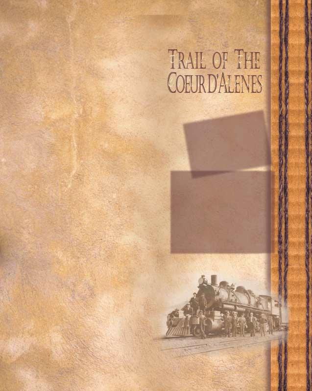
2 A TRULY UNIQUE TRAIL The "Trail of the Coeur d Alenes" is one of the most spectacular and popular trails in the western United States. Here, you will find 73 miles of newly laid asphalt that s perfect for road bikers and in-line skaters. The Trail of the Coeur d Alenes nearly spans the Panhandle of Idaho as it runs along rivers, beside lakes and through Idaho s historic Silver Valley. The uniqueness of the trail isn t simply the beautiful scenery and attractions along its route, but it s an innovative solution to the environmental problems caused by the early miners in the Valley. Silver was discovered in the Valley around 1884 and construction of the rail line to support the growing mining and timber industries was started in Much of the trail today follows this original rail line, giving it a gentle grade. When the rail line was built, mine waste rock and tailings containing heavy metals were used for the original rail bed. In addition, the bed was contaminated with accidental ore concentrate spillage. Now, the trail itself is part of the environmental cleanup in a partnership between the Union Pacific Railroad, the U.S. Government, the State of Idaho and the Coeur d Alene Tribe. The thick layer of asphalt on the trail and the gravel barriers along the trail serve to isolate the contaminants and allow the area to be used once again. Although not all of the trail is susceptible to recontamination, it s best to use caution and follow trail rules. The section between Plummer and Harrison has been thoroughly cleaned and is not susceptible to recontamination. Because the section between Harrison and Mullan is vulnerable to flooding, contaminants may be in the soil around the trail. Please stay on the trail and in designated picnic areas. PROTECT YOURSELF BY FOLLOWING THE RULES Stay on the trail. Wash hands and face before eating. Eat at designated waysides and trailheads. Remove dirt from clothes, toys, pets, shoes, and equipment before leaving the area. Don t let children play near shorelines or off the trail. Carry water for drinking and washing.


3 Attractions Northern Pacific Depot Railroad Museum This railroad museum is located in an historic depot listed on the National Register of Historic Places. The museum transports you back to the time when railroads were the king of transportation. Exhibits tell of the rich history of railroading in the Coeur d Alene Mining District and of the depot itself. You can see a rare 13-foot glass map of the Northern Pacific Railroad. Sierra Silver Mine Tour This unique tour offers a rare opportunity to personally experience the heritage of the Silver Valley. The tour begins by boarding a sixteen-passenger trolley. On the short trip to and from the mine portal, a narrated tour of Wallace is provided. Hard hats are issued at the entrance and an experienced guide takes you through the main tunnel of the mine. Crane House in Harrison Harrison has a colorful historical heritage and the Crane Historical Society perpetuates it in the Crane House Museum. It contains historical infor- mation and artifacts from the late 1890s and early 1900s. The old jail, a structure constructed entirely of 2 x 4 s and built around 1920, has been moved to the Crane House site. Coeur d Alene s Old Mission State Park The state park features the oldest standing building in Idaho, the Mission of the Sacred Heart. Also known as Cataldo Mission, it was built between 1848 and 1853 by members of the Coeur d Alene Tribe and Catholic missionaries. The building has walls one-foot thick and was built entirely without nails. The park also has a restored parish house next door to the Mission and an historic cemetery. Heyburn State Park This is the oldest state park in the Pacific Northwest. Over 5000 acres of forested land invites you to explore its more than 22 miles of backcountry trails. Three lakes and the St. Joe River make up the 2300 acres of clean, clear water that beckons to water lovers. Heyburn has three campgrounds, one adjacent to the trail. Heyburn s cruise boat, the Idaho, offers relaxing brunch and dinner cruises and an occasional cruise to Harrison. Kellogg At the heart of the Silver Valley, a rich mining area east of Coeur d Alene is Kellogg, named for the man who discovered the largest silver strike in the area. Kellogg is home to the world s longest gondola, Silver Mountain Ski Resort, Crystal Gold Mine, Staff House Museum and more.


4 What to expect You don t have to be fit to enjoy this trail with its gentle grade and smooth surface. The trail has 20 developed trailheads and 17 scenic waysides that have picnic tables and benches. Dispersed along the trail are 36 unique bridges and trestles that cross mountain creeks, whitewater rivers and tranquil lakes. The east end of the trail passes through a narrow mountain valley once heavily mined for silver. The valley is dotted with numerous small historic mining communities each offering their own unique features. The middle section of the trail follows the tranquil Coeur d Alene River, passing fifteen small lakes and marshes loaded with waterfowl. The west end of the trail lies along the shoreline of scenic Coeur d Alene Lake for six miles. It crosses a 3100-foot bridge/trestle to Heyburn State Park, the Northwest s oldest state park. The trail then follows the remote forested Plummer Creek canyon for six miles, ending in the community of Plummer. Trail management The trail is divided into two sections based on management. The Coeur d Alene Tribe manages the portion of the trail within their reservation boundary (14.5 miles between Plummer and Harrison). The Idaho Department of Parks and Recreation manages the rest of the trail from Harrison to Mullan. Through a joint powers agreement, numerous cities and counties have agreed to assist the trail managers with law enforcement and maintenance. Flora & fauna Wildlife is abundant along the trail. The best time to see wildlife is in the evening along the more remote sections between Enaville and Harrison. In this chain of lakes section you will find a large population of waterfowl and other water-based animals. Moose, osprey, eagles, herons, otters, and beavers are a few of the many animals you may see. The ecosystem ranges from narrow mountain valleys to low marshland. Expect to see white pine and douglas fir in the upper reaches of the trail and willows, cottonwood and ponderosa pine in the lower section. In the fall the wooded hillsides and trees surrounding the chain of lakes are ablaze with color. With the abundance of water, numerous plants are present such as water lilies, cattails and wild rice. Hunting & Fishing recommended due to shoreline contamination. Fishing is also discouraged on leased or private land. Fishing from bridges is encouraged but use caution when back casting. Hunters may use the trail for access to other hunting property. Discharge of firearms or hunting from or across the trail corridor is prohibited. Fishing is allowed along the entire corridor, but not

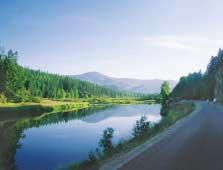
5 T he newly constructed 73 mile long asphalt trail nearly spans the Panhandle of Idaho. The trail, which starts in Plummer, generally follows the shoreline of Coeur d Alene Lake then passes through a chain of lakes and marshland evnvironment and follows the scenic Coeur d Alene River up into the mountains to Mullan. Enjoy this Northwest treasure. Special Events Any group wishing to host a special event or commercial activity on the trail must have authorization from the trail manager. Please see the useful phone numbers section for contact information. Trail Etiquette Be courteous to all users Slower traffic has right of way Do not block path No more than two abreast Bikers yield to pedestrians Use safe speed Signal when approaching from the rear Keep right except to pass Control your dog and pack out excrement Do not litter (pack in/ pack out)


6 Future Possibilities In the next few years we will better understand how people use the trail and what they expect from it. With community support, we anticipate How I Can Help The trail s potential cannot be reached without the help of the citizens who live and work there. Volunteers can adopt a section of the trail to help the manager keep a watchful eye on it and to assist in picking up litter. In addition, you can help to enhance the trail by making a taxdeductible donation to the non-profit group, the Idaho Foundation for Parks and Lands at Idaho Department of Parks & Recreation and the Coeur d Alene Tribe Useful Equipment Water Daypack High-energy food Small first-aid kit Trail map / brochure Sunglasses Sunscreen Camera and film connecting the west end of the trail to the Washington State John Wayne Pioneer rail trail which travels from Seattle to Tekoa. We hope to connect the east end of the trail from Mullan to the Route of the Hiawatha rail trail on the Montana border. We also expect to add parking lots and expand or install additional toilets. Legend Safety Tips Bikers and in-line skaters should always wear helmets Always use lights at night Obey road crossings signs Additional interpretive signs are planned along the trail so you can learn about the colorful history of the area. 3,400 3,200 3,000 2,800 2,600 2,400 2,200 2,000 Change in Elevation If you are looking for a downhill experience, the legend below will help you plan your starting point on the trail. Mullan Wallace Kellogg Cataldo Chatcolet Plummer


7 Weather The climate in the area is as varied as its landscape. Weather is influenced by Pacific weather patterns, which moderate temperature extremes. The average highs in June, July and August are in the 80s with lows in the 50s. In the winter, the lows can reach 20 with highs near freezing. You can expect snow on the ground for about a month on the Cataldo to Plummer section while the upper canyon sections near Mullan and Wallace can expect plenty of snow from December to March for Nordic skiing or snowmobiling. Rain and snow are frequent due to the mountainous terrain. Call the National Weather Service forecast line at or check out for an on-line forecast. Other area trails THE ROUTE OF THE HIAWATHA TRAIL The Route of the Hiawatha is one of the most breathtaking scenic stretches of rail trail in the country. Winding through 10 tunnels and across 7 high trestles, this 15-mile route crosses the rugged Bitterroot Mountains between Idaho and Montana. The Route of the Hiawatha is best known for the long, dark St. Paul Pass, or "Taft" Tunnel, which burrows for 1.7 miles under the state line. The trail is located approximately 20 miles south of Wallace, Idaho. For more information about this trail, call or visit www. skilookout.com. If you are driving in the winter call for Idaho road conditions.


8 Respect private property There are many miles of private land adjacent to the trail corridor. Please stay on the trail to prevent confrontation with landowners. Respect their privacy and obey the no trespassing signs. Please do not access the numerous private docks and boats along Coeur d Alene Lake. types of use allowed The trail is a 10-foot wide asphalt trail open to walking, in-line skating, road/mountain biking, Nordic skiing and snowshoeing. Horses and pack stock are not allowed on the trail so No Camping or fires Camping is not allowed along the entire trail corridor due to health concerns. For those who wish to travel and camp along the trail, private and public campgrounds are located close by. No campfires or discharge of fireworks are allowed within the trail corridor. Drinking water Please do not drink surface water even if filtered. Safe water sources can be found in each community and at some trailheads. Bring plenty of water along because some sections of the trail are remote. Glass containers are discouraged. Pet policy as not to damage the asphalt and gravel barriers, which isolate the contamination. No motorized vehicles are allowed on the trail except for a short portion from Wallace to Mullan where snowmobiles are allowed when there is enough snow to protect the trail surface. The trail manager will decide when snowmobile use will end by posting restrictions at both ends of the trail. Electric wheelchairs are allowed on the trail. Dogs are welcome but must remain on a short leash and be under control. Owners should pack their pet s excrement out, so please carry a plastic bag. Much of the trail is a wildlife viewing area, so do not allow your pet to leave the trail. uses not allowed No ATVs, electric golf carts, electric or gas powered bicycles, four-wheel drive vehicles or any motorized vehicles are allowed on the trail, shoulder of the trail or within the trail corridor.


9 useful phone numbers Management TRIBE TRAIL MANAGER, Coeur d Alene Tribe, P. O. Box 408, Plummer ID dchapman@cdatribe-nsn.gov STATE TRAIL MANAGER, Idaho Department of Parks and Recreation, Coeur d Alene s Old Mission State Park P.O. Box 30, Cataldo ID old@idpr.state.id.us Emergency Services Coeur d Alene Tribal Police Shoshone County Sheriff Benewah County Sheriff Kootenai County Sheriff Idaho State Police Ambulance/Fire 911 HOSPITALS Shoshone Medical Center in Kellogg Benewah Medical Center in Plummer Benewah Community Hospital in St. Maries Other Agencies Idaho State Department of Environmental Quality US Environmental Protection Agency Panhandle Health District USFS Coeur d Alene River Ranger District Heyburn State Park Coeur d Alene s Old Mission State Park Idaho Department of Fish and Game Coeur d Alene Tribe Natural Resources Department Local Governments City of Mullan City of Wallace City of Osburn City of Kellogg City of Smelterville City of Pinehurst City of Harrison City of Plummer Shoshone County Kootenai County Kootenai County Park District Benewah County Visitor Services Harrison Chamber of Commerce ( Historic Silver Valley Chamber of Commerce ( Wallace Chamber of Commerce ( Snowmobile Conditions BIKE REPAIR SERVICE AND RENTALS Excelsior Cycle & Sport Shop in Kellogg Pedal Pushers Rental & Repair in Harrison MUSEUMS AND ATTRACTIONS Crystal Gold Mine Silver Mountain Resort Staff House Mining Museum Sierra Silver Mine Tour NP Depot Railroad Museum Oasis Bordello Museum Wallace District Mining Museum Crane House Museum at Harrison Heyburn State Park Boat Cruises Plummer Wellness Center Wallace Mining Museum
Stephens State Park Trails
 TRAILS OF ALLAMUCHY MOUNTAIN & STEPHENS STATE PARKS Allamuchy Mountain and Stephens State Parks contain 28 marked trails providing access to diverse landscapes for walking, hiking, biking, bird-watching,
Hayden Lake Country Club Visitor's Guide
 Hayden Lake Country Club Visitor's Guide The communities of Hayden and Hayden Lake are located in the beautiful panhandle of North Idaho in Kootenai County, approximately 37 miles east of Spokane, Washington
National Recreation Trail Update Form
 National Recreation Trail Update Form Introduction Thank you for taking the time to complete this form. Your assistance will help ensure that the National Recreation Trail (NRT) database is complete and
CHAPTER 5. Chapter 5 Recreation Element
 CHAPTER 5 Recreation Element Chapter 5 Recreation Element The Recreation Element of the Meyers Area Plan is a supplement to the Recreation Element of the TRPA Regional Plan and the El Dorado County General
TAYLOR CANYON RANCH COLORADO - ROUTT COUNTY - STEAMBOAT SPRINGS
 TAYLOR CANYON RANCH COLORADO - ROUTT COUNTY - STEAMBOAT SPRINGS Tucked up against the steep valley shaped by Mt. Pau and rising to the Routt National Forest, Taylor Canyon Ranch is an easily accessible,
National Recreation Trail Application for Designation
 National Recreation Trail Application for Designation Introduction Thank you for your interest in the National Recreation Trail (NRT) program. Completed NRT application packages must be submitted by December
Ortiz River Ranch Pagosa Springs, Colorado
 Ortiz River Ranch Pagosa Springs, Colorado This ranch provides an exceptional opportunity to own a property with frontage on the San Juan and Navajo Rivers, lush irrigated pastures, and beautiful rolling
Preferred Recreation Recommendations Stemilt-Squilchuck Recreation Plan March 2018
 Preferred Recreation Recommendations Stemilt-Squilchuck Recreation Plan March 2018 Below are the recommended recreation ideas and strategies that package together the various recreation concepts compiled
13.1 REGIONAL TOURISM ISSUES AND SUMMARY OF FINDINGS
 13 REGIONAL TOURISM T he County of Mariposa s recreation needs and facilities fall within two categories: regional tourism and local recreation. This Element focuses on regional tourism issues related
5.0 OUTDOOR RECREATION OPPORTUNITIES AND MANAGEMENT
 5.0 OUTDOOR RECREATION OPPORTUNITIES AND MANAGEMENT 5.1 Introduction This section describes the range of recreational activities that currently take place in Marble Range and Edge Hills Parks, as well
Mazatzal Wilderness Trail Maintenance and Exploration
 Mazatzal Wilderness Trail Maintenance and Exploration March 15-19 (Wednesday - Sunday) Difficulty: Beginner Camping: Car Camping Mileage: Wednesday ~4 miles Thursday ~4-6 miles Friday ~4-6 miles Saturday
Crystal Lake Area Trails
 Lake Area Trails Welcome to the Lake area of the Big Snowy Mountains! This island mountain range in central Montana features peaks reaching to 8,600 feet and long, high ridges from which vistas of the
Dumont Dunes Special Recreation Management Area (SRMA)
") Dumont Dunes Special Recreation Management Area (SRMA) RMA/RECREATION MANAGEMENT ZONE (RMZ) OBJECTIVE(S) DECISIONS Objective Statement: Designate this area as a Special Recreation Management Area. To manage
Dumont Dunes Special Recreation Management Area (SRMA) RMA/RECREATION MANAGEMENT ZONE (RMZ) OBJECTIVE(S) DECISIONS Objective Statement: Designate this area as a Special Recreation Management Area. To manage
Lewis and Clark Recreation Area
 Lewis and Clark Recreation Area Bicycle/Pedestrian Trail Also part of the Pierson Ranch Recreation Area trail Type of trail: Walking, biking and rollerblading Trail surface: Asphalt Rated: Mostly flat.
Morgan Estates. Lassen County, CA. Proudly Offered By
 Morgan Estates Lassen County, CA Proudly Offered By 707 Merchant Street, Suite 100, Vacaville, Ca 95688 (707) 455-4444 Office (707) 455-0455 Fax info@caoutdoorproperties.com Introduction Looking North
Trail Etiquette. Hours of Operation. Trail Accessibility
 Trail Guide The Elmhurst Park District, with 28 parks and over 460 acres of land, offers nearly six miles of paved or asphalt park trails and maintains an additional 3.6 miles of trails within Elmhurst.
Logo Department Name Agency Organization Organization Address Information 5700 North Sabino Canyon Road
 Logo Department Name Agency Organization Organization Address Information United States Forest Coronado National Forest 5700 North Sabino Canyon Road Department of Service Santa Catalina Ranger District
Segment 2: La Crescent to Miller s Corner
 goal of the USFWS refuges is to conserve, protect and enhance fish, wildlife and plants and their habitats for the continuing benefit of the American people. Refuge lands are used largely for fishing,
Great Allegheny Passage
 Great Allegheny Passage Two documents are provided: Great Allegheny Passage Special Use Permit Application Great Allegheny Passage Rules and Guidelines. Great Allegheny Passage Allegany County Government
Table of Contents. page 3 Long term Goals Project Scope Project History. 4 User Groups Defined Trail Representative Committee. 5 Trail Users Breakdown
 Launched April 27th, 2010 1 Table of Contents page 3 Long term Goals Project Scope Project History 4 User Groups Defined Trail Representative Committee 5 Trail Users Breakdown 13 Trail Users Desires 16
GENERAL INFORMATION SIGNS
 GENERAL INFORMATION SIGNS I 1-1 THROUGH I14-1b RECREATIONAL AND CULTURAL INTEREST AREA SIGNS Michigan Department of Transportation Traffic and Safety PW Reference Documents\Traffic Reference\Typicals\Develop\Sign_StdHwySigns_D\i00_titlepage_i.dgn
Stephens Rd. Nature Preserve
 Stephens Rd. Nature Preserve History Stephens Road Nature Preserve (SRNP) is a 350-acre nature preserve in Huntersville that comprises nine properties purchased between 1994 and 2008. Parcels included
A Publication of Friends of Sleeping Bear Dunes
 A Publication of Friends of Sleeping Bear Dunes 2014, Friends of Sleeping Bear Dunes, P.O. Box 545, Empire, MI 49630 www.friendsofsleepingbear.org info@friendsofsleepingbear.org Learn more about the Friends
2019 DAY HIKE AT IRON MOUNTAIN SATURDAY, JANUARY 19
 WHERE? In Google Maps, paste the following coordinates for Iron Mountain: 32.978215,-116.972593 or CLICK ON THIS LINK. I. Purpose of the Day Hike A. THE WBC Day Hike is a relatively short trail hike to
Please Tell Us What You Think: Candidate Sites for Recreation Business Activities
 Please Tell Us What You Think: Candidate Sites for Recreation Business Activities Background In January 2015, the Washington State Parks and Recreation Commission (Commission) approved some forms of privately
SUMMER ACTIVITIES GOLF
 SUMMER ACTIVITIES GOLF Designed by Robert Trent Jones Sr., the two acclaimed courses: Mt. Kidd and Mt. Lorette are a golfer s paradise! Ranked among the world s best, the Kananaskis Country Golf Course
1 Permanent Full Time Forester GS /07/09 Kaibab National Forest Duty Station: Williams or Tusayan, AZ
 1 Permanent Full Time Forester GS-460-05/07/09 Kaibab National Forest Duty Station: Williams or Tusayan, AZ Merit Vacancy Announcement: Open Monday January 11 th to Friday January 20 th 2016 and working
St. Joe Travel Management EA CULTURAL RESOURCES
 St. Joe Travel Management EA CULTURAL RESOURCES Bruce Gibson May 2015 Regulatory Framework Forest Plan The Idaho Panhandle National Forests (IPNF) Forest Plan requires systematic cultural resource inventory
METROPOLITAN COUNCIL 390 North Robert Street, St. Paul, MN Phone (651) TDD (651)
 TDD (651)") METROPOLITAN COUNCIL 390 North Robert Street, St. Paul, MN 55101 Phone (651) 602 1000 TDD (651) 291 0904 DATE: June 19, 2007 TO: Metropolitan Parks and Open Space Commission FROM: Jan Youngquist, Senior
METROPOLITAN COUNCIL 390 North Robert Street, St. Paul, MN 55101 Phone (651) 602 1000 TDD (651) 291 0904 DATE: June 19, 2007 TO: Metropolitan Parks and Open Space Commission FROM: Jan Youngquist, Senior
Skiing and Snowshoes on Un-groomed Fernan Saddle Terrain
 Skiing and Snowshoes on Un-groomed Fernan Saddle Terrain Three ski or snowshoe routes are available from the Fernan Saddle Parking Lot which either do not cover routes ordinarily groomed for snow machine
GENERAL INFORMATION SIGNS
 GENERAL INFORMATION SIGNS I 1-1 THROUGH I13-2 RECREATIONAL AND CULTURAL INTEREST AREA SIGNS CLEARVIEW FONT MI/2012 Michigan Department of Transportation PW: Reference Docum ents\traffic Reference\Typicals\Develop\Sign_StdHwySigns_D\I00_titlepage_e.dgn
Chapter 6: POLICY AND PROCEDURE RECOMMENDATIONS
 Chapter 6 POLICY AND PROCEDURE RECOMMENDATIONS FOR SRRA Below are seven policy elements that should be considered for adoption by the Southwest Regional Recreation Authority of Virginia: 1. Develop strategies
SOUTH NEW MEADOWS R-1 R-3 PRIME DEVELOPMENT LAND FOR SALE. S Norris Ave South End Rd. prime residential growth location. for sale 69.
 S Norris Ave South End Rd SUBSTATION ROAD new meadows, idaho 83654 prime residential growth location R-1 R-3 for sale 69.15 acres total CONTACT: Lenny Nelson 208.947.0806 lenny@ Sam McCaskill 208.947.0804
Rogue River Access and Management Plan Draft Alternatives
 Rogue River Access and Management Plan Draft Alternatives The Rogue River Access and Management Plan was initiated in December, 2011 and is being led by Jackson County Parks (JCP) and Oregon Department
Blue River Trail Master Plan JSA to Town Hall June 2004
 Blue River Trail Master Plan JSA to Town Hall June 2004 Prepared for: Silverthorne Town Council Silverthorne SPORT Committee Department of Recreation and Culture Silverthorne Public Works Silverthorne
Glacier National Park
 Glacier National Park West Glacier, MO Page 1 Page 3-6 Report Rough Draft Glacier National Park Glacier National Park is located in the northwest corner of Montana and extends into Canada. It is located
MANAGEMENT DIRECTION STATEMENT June, 1999
 Thompson River District MANAGEMENT DIRECTION STATEMENT June, 1999 for Clearwater River Corridor (Addition to Wells Gray Park) Ministry of Environment Lands and Parks BC Parks Division ii Table of Contents
Ponderosa Pines Ranch
 PONDEROSA PINES RANCH Ponderosa Pines Ranch Shepherd, Montana $3,285,000. Offered Exclusively By: Sonny Todd Real Estate 301 W First, PO Box 788 Big Timber, MT 59011 Office: (406) 932-6668 (406) 932-LAND
Weston County, Wyoming
 The Sweet 200-Acre Property Weston County, Wyoming A unique opportunity to own a little piece of the old West, where one can experience unparalleled scenery, adventure and history walk in the footsteps
Other Agencies and Organizations
 Daniel Boone National Forest 1700 Bypass Road WInchester, KY 40391 859-745-3100 Location Northern terminus is near Morehead, Kentucky. Southern terminus is located in the Big South Fork NRRA in Tennessee.
South Colony Basin Recreation Fee Proposal
 South Colony Basin Recreation Fee Proposal Purpose and Need for Collecting Fees in South Colony Basin: Forest Service appropriated funds have not been sufficient to maintain current recreational services
Camping (Primitive) Camping (RV) Electrical Potable Water Grill Established Fire Pit Picnic Table
 Camping (RV) Electrical Potable Water Grill Established Fire Pit Picnic Table") Alden - 9th Road River Mile 777 Map: 38.20833, -98.32031 Managing Agency: Kansas Department of Wildlife, Parks & Tourism Nearest Community: Alden, Rice County Kansas Developed Amenities Provided Parking
Alden - 9th Road River Mile 777 Map: 38.20833, -98.32031 Managing Agency: Kansas Department of Wildlife, Parks & Tourism Nearest Community: Alden, Rice County Kansas Developed Amenities Provided Parking
WASHINGTON STATE PARKS AND RECREATION COMMISSION POLICY/PROCEDURE
 WASHINGTON STATE PARKS AND RECREATION COMMISSION POLICY/PROCEDURE 65-13-1 Use of Other Power-Driven Mobility Devices by Persons with Mobility Disabilities at State Park Facilities See Also: 28 CFR 35 Title
CRANE LAKE TRAILS NETWORK AND SPACES
 CRANE LAKE TRAILS NETWORK AND SPACES AREA TRAILS COMMUNITY TRAILS GOLD COAST TRAIL LAKE PARK OPTION ONE LAKE PARK OPTION TWO OVERFLOW TRAILHEAD PARKING THE GATE AREA TRAILS Trails are a major resource
Lincoln County ORP Survey Response Summary
 Lincoln County ORP Survey Response Summary North Central Wisconsin Regional Planning Commission Q1 Which recreational activities did you participate in during 2015? (Choose all that apply.) Answered: 125
Village of Taos Ski Valley 2015 Master Plan. Recreation Element
 Village of Taos Ski Valley 2015 Master Plan Taos Ski Valley is known across the world for skiing and winter sports, but the Village has more to offer than advanced skiing terrain and short lift lines.
BUCK POINT RANCH. Aspen Associates Realty
 BUCK POINT RANCH Aspen Associates Realty www.aspenassociatesrealty.com 970.544.5800 WELCOME TO Buck Point Ranch is a 960± acre property located in one of the last pristine valleys in close proximity to
System Group Meeting #1. March 2014
 System Group Meeting #1 March 2014 Meeting #1 Outcomes 1. Understand Your Role 2. List of Revisions to Existing Conditions 3. Information Sources Study Area The Purpose of Mountain Accord is to Preserve
Nov. 19 th Public Workshop Summary
 On November 19 th, more than 60 community members attended an Open Space Matters workshop at the Linen Building in downtown Boise for over two hours. Participants learned about reserves, discussed the
2/7/2012. Mission Mountains Wilderness Contracting as a management alternative Climb the mountains and get their good tidings John Muir
 Wilderness Contracting as a management alternative Climb the mountains and get their good tidings John Muir Kari Gunderson Wilderness Education and Management Specialist Swan Valley, Montana In memory
BACK COUNTRY UNIT PREFERRED ALTERNATIVE
 BACK COUNTRY UNIT PREFERRED ALTERNATIVE San Francisco (118 mi) Carmel-By-The-Sea Carmel River Carmel Valley Road State Beach Private Property Point Lobos State Reserve Point Lobos Ranch RUSTIC CAMPING
Idaho Native Plant Society 2018 Annual Meeting
 Idaho Native Plant Society 2018 Annual Meeting Hosted by: Calypso Chapter, Idaho Native Plant Society, Coeur d Alene, Idaho Dates: Friday thru Monday, June 29 thru July 2, 2018 Meeting Location: US Forest
West Orange Trail. Clean, Green, Fun!
 West Orange Trail Clean, Green, Fun! The West Orange Trail - when completed - will be a 36-mile, multipurpose recreational greenway containing a 14-foot wide paved surface to be enjoyed by walkers, joggers,
4.0 OUTDOOR RECREATION 4.1 PUBLIC LANDS
 4.0 OUTDOOR RECREATION 4.1 PUBLIC LANDS Public lands provide a wide range of recreational opportunities and are considered a valuable community asset. There may be seasonal and/or other use restrictions
Theme: Predominately natural/natural appearing; rustic improvements to protect resources. Size*: 2,500 + acres Infrastructure**:
 Recreation Opportunity Spectrum (ROS) Classes The Recreation Opportunity Spectrum (ROS) provides a way to describe the variations in the degree of isolation from the sounds and influences of people, and
RED MOUNTAIN HISTORIC DISTRICT ENHANCEMENT Grand Mesa, Uncompahgre, Gunnison National Forests Ouray Ranger District
 RED MOUNTAIN HISTORIC DISTRICT ENHANCEMENT Grand Mesa, Uncompahgre, Gunnison National Forests Ouray Ranger District Project Summary The Red Mountain President s Initiative Project proposes a comprehensive
RUSHMORE CONNECTOR TRAIL PROPOSAL
 PURPOSE AND NEED Background The U.S. Forest Service, Black Hills National Forest (Forest Service) has received a special use permit application from the State of South Dakota Department of Game, Fish and
BRYCE CANYON COUNTRY Boulder Mountain Scenic backways itinerary
 BRYCE CANYON COUNTRY Boulder Mountain Scenic backways itinerary Boulder Mountain Area The high plateaus of the Aquarius Plateau (Boulder Mountain), are heavily forested and covered in countless winding
STOWER SEVEN LAKES STATE RECREATION TRAIL POLK COUNTY, WISCONSIN. MASTER PLAN June, 2018
 STOWER SEVEN LAKES STATE RECREATION TRAIL POLK COUNTY, WISCONSIN MASTER PLAN June, 2018 Polk County Environmental Services Committee Kim O Connell-Chairman Brad Olson -Vice Chairman Jim Edgell Doug Route
Frizzell Creek Ranch Summerville, OR $1,400, ± Acres
 Frizzell Creek Ranch Summerville, OR $1,400,000 165± Acres 1 Introduction The Frizzell Creek Ranch is a beautiful 165± acre ranch located in northeast Oregon at the base of the Wallowa Whitman National
Roduner Ranch FOR SALE. 5,878± Acres Potential Development Land. Merced County, California. Offices Serving The Central Valley
 FOR SALE 5,878± Acres Potential Development Land Merced County, California Offices Serving The Central Valley F R E S N O V I S A L I A B A K E R S F I E L D 7480 N. Palm Ave, Ste 101 3447 S. Demaree Street
PBCH Newsletter October, 2018 Tails and Trails Page 1 Issue No. 10
 PBCH Newsletter October, 2018 Tails and Trails Page 1 Issue No. 10 Calendar of Events October **Saturday, October 20 monthly meeting. 6:30 socialize and 7 p.m. meeting starts. 6360 4 th St., Dalton Garden
KETTLE CREEK CONSERVATION AUTHORITY TRAIL GUIDE.
 KETTLE CREEK CONSERVATION AUTHORITY TRAIL GUIDE www.kettlecreekconservation.on.ca EXPLORE OUR TRAILS HIKE OUR TRAILS Kettle Creek Conservation Authority (KCCA) proudly supports and promotes an active lifestyle
Business Item No XXX. Proposed Action That the Metropolitan Council approve the Coon Creek Regional Trail Master Plan.
 Business Item No. 2015-XXX Metropolitan Parks and Open Space Commission Meeting date: July 7, 2015 For the Community Development Committee meeting of July 20, 2015 For the Metropolitan Council meeting
BRYCE CANYON COUNTRY. A twisted tree endures rugged life on the rim of the Paunsaugunt Plateau.
 BRYCE CANYON COUNTRY Grand Staircase - Paunsaugunt Plateau Scenic backways itinerary A twisted tree endures rugged life on the rim of the Paunsaugunt Plateau. Travel to Bryce Canyon Country. Lodging check-in,
Subj: POLICY FOR MAINSIDE TRAIL USE AT MARINE CORPS BASE QUANTICO
 UNITED STATES MARINE CORPS MARINE CORPS BASE QUANTICO, VIRGINIA 22134-5001 MCBO 5090.4 B 04 MARINE CORPS BASE ORDER 5090.4 From: Commander To: Distribution List Subj: POLICY FOR MAINSIDE TRAIL USE AT MARINE
Proposed Scotchman Peaks Wilderness Act 2016 (S.3531)
") 1 Proposed Scotchman Peaks Wilderness Act 2016 (S.3531) Frequently Asked Questions PLACE Where is the area that would be designated as Wilderness? The lands outlined in S.3531 lie within Idaho along its
1 Proposed Scotchman Peaks Wilderness Act 2016 (S.3531) Frequently Asked Questions PLACE Where is the area that would be designated as Wilderness? The lands outlined in S.3531 lie within Idaho along its
CRAZY HORSE TRAIL GUIDE
 CRAZY HORSE TRAIL GUIDE Abridged Version: July 2016 This is a short form of our interpretive trail guide for the Crazy Horse Trail. The full version of the guide has a more detailed description of the
At the time, the portion of the line through Eagle County remains wholly under the ownership of Union Pacific Railroad (UP).
.") Chapter 5 The Railroad Corridor as a Trail Corridor The intent of this chapter is to identify how the rail corridor, if available for lease or purchase in all or part, could be incorporated into the core
Chapter 5 The Railroad Corridor as a Trail Corridor The intent of this chapter is to identify how the rail corridor, if available for lease or purchase in all or part, could be incorporated into the core
Mammoth Winter Recreation Summit Saturday March 19, 2016
 Mammoth Winter Recreation Summit Saturday March 19, 2016 Track: Winter Recreation at Shady Rest Presenter: Haislip Hayes- Town of Mammoth Lakes (TOML) Presentation Notes 1. 12.5 acres of Shady Rest Park
Clearwater Lake Provincial Park. Draft Management Plan
 Clearwater Lake Provincial Park Draft Management Plan Clearwater Lake Provincial Park Draft Management Plan Table of Contents 1. Introduction... 3 2. Park History... 4 3. Park Attributes... 4 3.1 Location/Access...4
DAKOTA CULTURE UPPER SIOUX COMMUNITY: AREA CHARACTER ANALYSIS ALIGNMENT STRATEGY
 UPPER SIOUX COMMUNITY: AREA CHARACTER ANALYSIS ALIGNMENT STRATEGY 51 AREA CHARACTER ANALYSIS: OPPORTUNITIES & CONSTRAINTS RECREATIONAL VEHICLE PARK: A recreational vehicle park will be built to accommodate
Final Recreation Report. Sunflower Allotment Grazing Analysis. July 2015
 Final Recreation Report Sunflower Allotment Grazing Analysis July 2015 Table of Contents Introduction... 3 Affected Environment... 3 Four Peaks Wilderness Area... 3 Dispersed Recreation... 3 Environmental
Chambers of Commerce and Lake Groups advertised this NCWRPC created online survey that was : Opened: August 22, 2012; and Closed: October 4, 2012.
 Vilas County Outdoor Recreation Survey Chambers of Commerce and Lake Groups advertised this NCWRPC created online survey that was : Opened: August 22, 202; and Closed: October 4, 202. Q What Vilas County
LANGLADE COUNTY ICE AGE NATIONAL SCENIC TRAIL CONDITIONS
 LANGLADE COUNTY ICE AGE NATIONAL SCENIC TRAIL CONDITIONS (As of September 1, 2014) Due to situations beyond the control of the Langlade County Chapter of the Ice Age Trail Alliance, conditions are constantly
The Frank Church River of No Return Wilderness
 ALLIANCE FOR WILDERNESS EDUCATION AND STEWARDSHIP PO Box 2667, Bellingham, WA 98227-2667 Tele: 360-927-1804 Fax: 360-527-9679 bradt@wildernessalliance.org www.wildernessalliance.org STEWARDS OF AMERICA
APPENDIX 19-II. Ontario Trail Network Trailheads EAST-WEST TIE TRANSMISSION PROJECT AMENDED ENVIRONMENTAL ASSESSMENT REPORT
 EAST-WEST TIE TRANSMISSION PROJECT AMENDED ENVIRONMENTAL ASSESSMENT REPORT APPENDIX 19-II Ontario Network heads Report. 1536607/2000/2219 Ontario Network heads in the n-commercial Land and Resource Use
April 10, Mark Stiles San Juan Public Lands Center Manager 15 Burnett Court Durango, CO Dear Mark,
 Mark Stiles San Juan Public Lands Center Manager 15 Burnett Court Durango, CO 81301 Dear Mark, We are pleased to offer the following comments on the draft San Juan Public Lands Center management plans
in the St. Croix Valley
 in the Parks Your Guide to in the St. Croix Valley Our parks and trails are fun places to PowerUp! Explore the amazing, family-friendly parks and trails, right here in the St. Croix River Valley. Use this
TRAILS WHERE TO FIND TRAILS IN NOVA SCOTIA
 TRAILs SIGNAGE Know the Signs............................ 44 WHERE YOU CAN RIDE Roads and Highways........................ 46 Designated Trails........................... 47 Established Trails...........................
Hermosa Area Preservation The Colorado Trail Foundation 4/11/2008
 Hermosa Area Preservation The Colorado Trail Foundation 4/11/2008 Legend d o Tr ail NPA - National Protection Area ra NCA - National Conservation Area o e C Th The Colorado Trail lo FS inventoried Roadless
MORGAN CREEK GREENWAY Final Report APPENDICES
 APPENDICES MORGAN CREEK GREENWAY Appendix A Photos of Existing Conditions in Trail Corridor Photos of existing conditions Main trail corridor - February 2009 Photos of existing conditions south bank Morgan
BROCHURE. APPLE HILL WOODS 118 +/- Acres Camino, California. Presented by Jim Copeland
 BROCHURE APPLE HILL WOODS 118 +/- Acres Camino, California Presented by Jim Copeland 1 The Property This 118 acre is a rare gem in the Sierra Nevada foothills. Covered with lush forestland and scattered
F.O.K.O.S. Friends of Kingston Open Space A GUIDE TO KINGSTON OPEN SPACE
 F.O.K.O.S. Friends of Kingston Open Space A GUIDE TO KINGSTON OPEN SPACE Friends of Kingston Open Space (FOKOS) was formed when a handful of concerned citizens joined together to learn what could be done
Yellowstone & Grand Teton: Walking America s First National Park
 Yellowstone & Grand Teton: Walking America s First National Park Yellowstone & Grand Teton: Walking America s First National Park A massive canyon carved by an ancient volcano plumes of water leaping into
Mission. Purpose. Idaho Trails Association promotes the continued enjoyment of Idaho s hiking trails.
 The Idaho Trails Association (ITA) is a non-profit 501(c)3. Mission Idaho Trails Association promotes the continued enjoyment of Idaho s hiking trails. Purpose To facilitate the active enjoyment of Idaho
Vail Valley Mountain Bike Association (VVMBA) is pleased to announce that their Adopt a Trail (AAT) program has expanded! Starting last spring, Adopt
 is pleased to announce that their Adopt a Trail (AAT) program has expanded! Starting last spring, Adopt") Vail Valley Mountain Bike Association (VVMBA) is pleased to announce that their Adopt a Trail (AAT) program has expanded! Starting last spring, Adopt a Trail added a new program called the Trail Ambassadors!
Vail Valley Mountain Bike Association (VVMBA) is pleased to announce that their Adopt a Trail (AAT) program has expanded! Starting last spring, Adopt a Trail added a new program called the Trail Ambassadors!
Greater Minnesota Regional Parks and Trails Commission Designation Application
 Greater Minnesota Regional Parks and Trails Commission Designation Application General Section Designation Application #: 15-059D Date Submitted: 06/16/2015 Park or Trail Name: Mesabi Trail District #:
What are you getting into?
 Overnight Camping What are you getting into? You will be hiking with your gear to a campground about ½ mile away and spending 1 night camping You will help to prepare a meal over an open flame You will
It is important that each student has a suitable mountain bike in working condition with treaded tires for gravel/dirt paths.
 Dear Riverstone Grade 7 Parents, During the Grade 7 fall outdoor education trip, students will have a memorable experience of riding a bike along the Weiser River Trail. The Weiser River Trail is an old
FINAL TESTIMONY 1 COMMITTEE ON RESOURCES UNITED STATES HOUSE OF REPRESENTATIVES. July 13, 2005 CONCERNING. Motorized Recreational Use of Federal Lands
 FINAL TESTIMONY 1 STATEMENT OF DALE BOSWORTH CHIEF Of the FOREST SERVICE UNITED STATES DEPARTMENT OF AGRICULTURE Before the SUBCOMMITTEE ON FORESTS AND FOREST HEALTH And the SUBCOMMITTEE ON NATIONAL PARKS,
Trails Classification Steering Team Alberta Tourism, Parks and Recreation Alberta Sustainable Resource Development Alberta TrailNet Society
 Acknowledgements Alberta Recreation Corridor and Trails Designation Program Alberta Recreation Corridors Coordinating Committee Trails Classification Steering Team Alberta Tourism, Parks and Recreation
Murphys Point Provincial Park
 Murphys Point Provincial Park FRONTENAC ARCH BIOSPHERE HIKING TRAIL GUIDE About The Trail A turn of the century mine, sawmill ruins, pioneer homesteads, sky-blue waters, and sylvan splendour are all to
Superintendent David Uberuaga June 27, 2011 Grand Canyon National Park P.O. Box 129 Grand Canyon, AZ 86023
 Superintendent David Uberuaga June 27, 2011 Grand Canyon National Park P.O. Box 129 Grand Canyon, AZ 86023 Dear Superintendent Uberuaga, Thank you for the opportunity to provide scoping comments on Grand
Logan Canyon Hiking Trail Guide
 C a c h e V a l l e y V i s i t o r s B u r e a u Logan Canyon Hiking Trail Guide Monique Beeley Legend Trail Location Guide WASATCH CACHE NATIONAL FOREST WILDERNESS PAVED WATER TRAILHEAD 9 Logan River
Cat Island Chain Background & Access Guide
 Cat Chain Background & Access Guide Brown County Port & Resource Recovery Department 2561 S. Broadway, Green Bay, WI 54304 (920) 492-4950 www.portofgreenbay.com January 2018 1 Restoration of the Cat Chain
Non-motorized Trail Plan & Proposal. August 8, 2014
 Town of Star Valley Ranch, Wyoming and the Star Valley Ranch Association in partnership with the USDA Forest Service, Bridger-Teton National Forest, Greys River Ranger District Non-motorized Trail Plan
GOLDEN EARS PROVINCIAL PARK
 GOLDEN EARS PROVINCIAL PARK Trail Information as of October 10 th 2015 Do not underestimate the mountainous wilderness of Golden Ears Provincial Park. The combination of rugged terrain and rapidly changing
CHAPTER VII: ASSETS, AMENITIES AND UNIQUE OFFERINGS
 CHAPTER VII Other Assets, Amenities, and Unique Offerings in the Tri- City Area The Tri- City area of Cumberland, Benham, and Lynch has numerous unique offerings that, in themselves, are major draws to
Payette National Forest Duty Station: New Meadows, Idaho Please respond by March 1, 2013
 THE OPPORTUNITY Payette National Forest Duty Station: New Meadows, Idaho Please respond by March 1, 2013 The Payette National Forest is currently seeking a candidate for a permanent full time Range Program