Trail Management Objectives (TMO s)
|
|
|
- Abigail Cook
- 5 years ago
- Views:
Transcription
1


2 Trail Management Objectives (TMO s)


3 TMO s are the foundation for solid, consistent trail planning, survey & design, construction, maintenance, periodic condition assessment & prescriptions, and on-going management.


4 The TMO Keystones


5 Trail Type Trail Class Managed Use Designed Use Design Parameters Our Reference Points were developed by.... United States Forest Service National Park Service Fish & Wildlife Service What Are Your Reference Points?
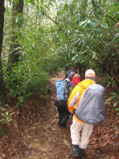
6 Trail A route 50 inches or less in width or a route over 50 inches wide that is identified and managed as a trail. Forest Trail A trail wholly or partly within or adjacent to and serving the National Forest System that the Forest Service determines is necessary for the protection, administration, and utilization of the National Forest System and the use and development of its resources.


7 What are the TMO s?


8 A fundamental trail category that indicates the predominant trail surface and the general mode of travel the trail accommodates.


9 Allow managers to identify specific technical specifications, management needs and the cost of managing the trail for particular uses and/or seasons by trail or trail segment. Only one Trail Type per trail, or... When multiple Trail Types are on same route: Identify each Trail with it s own Name, I.D., and Trail Type.

10

11 The prescribed scale of trail development, representing the intended design and management standards of the trail.
12 Only one Trail Class identified per trail or trail segment. Trail Classes define typical scenarios of combined factors, and exceptions may occur for any factor. Choose the one that most closely matches the managed objective of the trail.


13 The prescribed scale of trail development, representing the intended design and management standards of the trail. Only one Trail Class identified per trail or trail segment. The National Trail Classes provide a chronological classification of trail development on a scale ranging from Trail Class 1 to Trail Class 5 Trail Class 1: Minimal/Undeveloped Trail Trail Class 2: Simple/Minor Development Trail Trail Class 3: Developed/Improved Trail Trail Class 4: Highly Developed Trail Trail Class 5: Fully Developed Trail Each Trail Class is defined in terms of applicable Tread and Traffic Flow, Obstacles, Constructed Features.

14 Trail Class 1: Minimal/Undeveloped Trail

15 Trail Class 2: Simple/Minor Development Trail

16 Trail Class 3: Developed/Improved Trail


17 Trail Class 4: Highly Developed Trail


18 Trail Class 5: Fully Developed Trail


19 Designed Use Designed Use Types All Terrain Vehicle Snow All Terrain Vehicle Bicycle Dogsled Hiker / Pedestrian Motorcycle Pack and Saddle Snowmobile Snowshoe Motorized Watercraft Non-Motorized Watercraft Cross Country Ski

20 The mode(s) of travel that are actively managed and appropriate, considering the design and management of the trail.
21 There may be more than one Managed Use per trail or trail segment. Managed Use indicates a management decision or intent to accommodate and/or encourage a specified type of trail use.
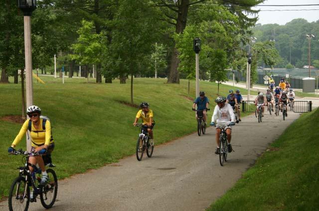
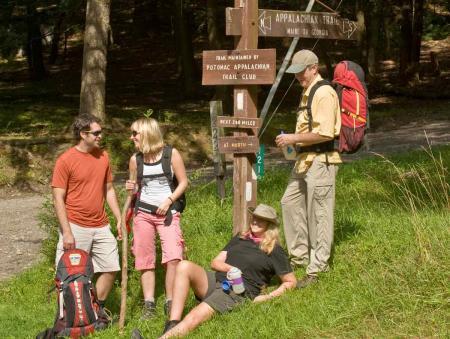
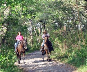
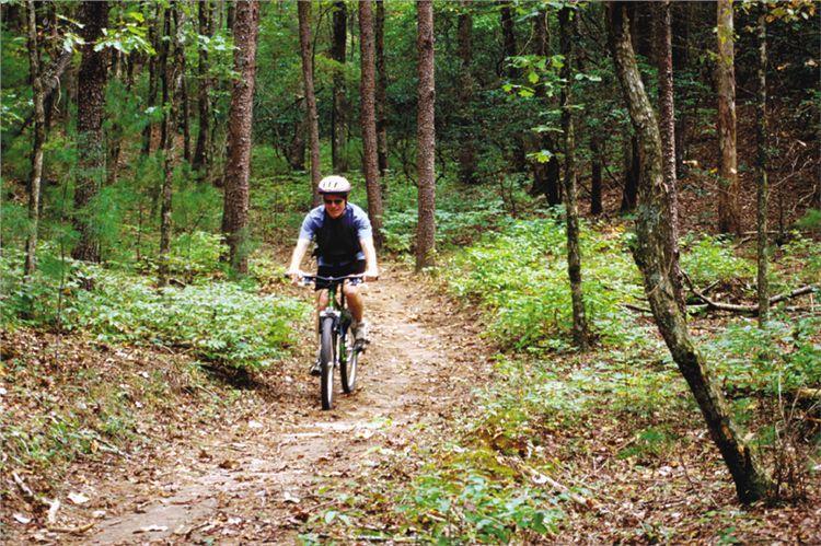
22 Hiker / Pedestrian Bicycle Pack and Saddle Motorcycle All Terrain Vehicle Cross Country Ski Snowshoe Dogsled Snowmobile Motorized Watercraft Non-Motorized Watercraft
23 The intended use that controls the desired geometric design and determines the subsequent maintenance parameters for the trail.
24 Although the trail may be actively managed for more than one use, and numerous uses may be allowed... there is only one Designed Use per trail or trail segment.

25 Hiker / Pedestrian Bicycle Pack and Saddle Motorcycle All Terrain Vehicle Cross Country Ski Snowshoe Dogsled Snowmobile Motorized Watercraft Non-Motorized Watercraft
26 Determines technical specifications for trail design, construction and maintenance For each Designed Use and applicable Trail Class, there s a corresponding set of standardized technical specifications.

27 Design Parameters


28 Technical specifications for trail construction and maintenance, based on the Designed Use and Trail Class.


29 Design Tread Width Design Surface Design Grade Design Cross Slope Design Clearing Design Turns
30 Standardized set of construction and maintenance specifications based on Designed Use and Trail Class. Local deviations may be established based on specific trail conditions, topography and other factors..provided that they continue to reflect the general intent of the Trail Classes.

31 Putting it all together


32 Trail Type Trail Class Managed Use Designed Use Design Parameters Efficient Trail Planning, Design, Construction & Management Consistent, Quality Data Accurate, Accountable Inventory & Costing
33
Federal Register Environmental Documents. National Trail Classification System, FSM 2350, and FSH
 EPA: Federal Register: National Trail Classification System, FSM 2350, and FSH 2309.18 Page 1 of 33 Federal Register Environmental Documents Recent Additions Contact Us Search: EPA Home > Federal Register
CHAPTER III: TRAIL DESIGN STANDARDS, SPECIFICATIONS & PERMITS
 CHAPTER III Trail Design Standards, Specifications & Permits This chapter discusses trail standards, preferred surface types for different activities, permits, and other requirements one must consider
FOREST SERVICE HANDBOOK NATIONAL HEADQUARTERS (WO) WASHINGTON, DC
 WASHINGTON, DC") Page 1 of 48 FOREST SERVICE HANDBOOK NATIONAL HEADQUARTERS (WO) WASHINGTON, DC Amendment No.: 2309.18-2008-4 Effective Date: October 16, 2008 Duration: This amendment is effective until superseded or removed.
Page 1 of 48 FOREST SERVICE HANDBOOK NATIONAL HEADQUARTERS (WO) WASHINGTON, DC Amendment No.: 2309.18-2008-4 Effective Date: October 16, 2008 Duration: This amendment is effective until superseded or removed.
Policies, Guidelines, and Standards for Trails in Alberta Highway Rights-of-way
 Policies, Guidelines, and Standards for Trails in Alberta Highway Rights-of-way Author/Presenter, Sean Willis, P.Eng., Transportation Associate, Stantec Consulting Ltd. Co-Author/Presenter, Steve Otto,
Trails Classification Steering Team Alberta Tourism, Parks and Recreation Alberta Sustainable Resource Development Alberta TrailNet Society
 Acknowledgements Alberta Recreation Corridor and Trails Designation Program Alberta Recreation Corridors Coordinating Committee Trails Classification Steering Team Alberta Tourism, Parks and Recreation
National Recreation Trail Update Form
 National Recreation Trail Update Form Introduction Thank you for taking the time to complete this form. Your assistance will help ensure that the National Recreation Trail (NRT) database is complete and
FOREST SERVICE MANUAL NATIONAL HEADQUARTERS (WO) WASHINGTON, DC
 WASHINGTON, DC") Page 1 of 77 FOREST SERVICE MANUAL NATIONAL HEADQUARTERS (WO) WASHINGTON, DC FSM 2300 RECREATION, WILDERNESS, AND RELATED RESOURCE MANAGEMENT CHAPTER TRAIL, RIVER, AND SIMILAR RECREATION OPPORTUNITIES
Page 1 of 77 FOREST SERVICE MANUAL NATIONAL HEADQUARTERS (WO) WASHINGTON, DC FSM 2300 RECREATION, WILDERNESS, AND RELATED RESOURCE MANAGEMENT CHAPTER TRAIL, RIVER, AND SIMILAR RECREATION OPPORTUNITIES
Blueways: Rivers, lakes, or streams with public access for recreation that includes fishing, nature observation, and opportunities for boating.
 Parks, Open Space and Trails PRINCE WILLIAM COUNTY 2008 COMPREHENSIVE PLAN TRAILS PLAN CONTENTS The components of the trails plan are: Intent Definitions Goals, Policies, and Action Strategies Trails Map
BAYFIELD COUNTY FOREST COMPREHENSIVE LAND USE PLAN TABLE OF CONTENTS CHAPTER 700 ACCESS MANAGEMENT ROADS AND TRAILS
 BAYFIELD COUNTY FOREST COMPREHENSIVE LAND USE PLAN TABLE OF CONTENTS CHAPTER 700 ACCESS MANAGEMENT ROADS AND TRAILS 700 Access Management/Roads and Trails 3 700.1 History 3 700.2 Current Status 3 700.3
APPENDIX D: SUSTAINABLE TRAIL DESIGN. APPENDICES Town of Chili Parks and Recreation Master Plan Update
 APPENDIX D: SUSTAINABLE TRAIL DESIGN APPENDICES Town of Chili Parks and Recreation Master Plan Update Sustainable Trail Construction Sustainable trails are defined by the US Forest Service as trails having
URBAN DESIGN REPORT. Proposed Residential Development, Old Church Road, Caledon East
 Proposed Residential Development, Old Church Road, Caledon East TABLE CONTENTS: 1.0 DEVELOPMENT 1.1 Introduction-Analysis of Guiding Principles and Documents 1.2 Community Design and Architectural Design
Outdoor Developed Areas
 The United States Access Board is an independent federal agency that promotes equality for people with disabilities through leadership in accessible design and the development of accessibility guidelines
What s covered. What s not covered. Options for those not covered. ABA Coverage
 The United States Access Board is an independent federal agency that promotes equality for people with disabilities through leadership in accessible design and the development of accessibility guidelines
FEASIBILITY CRITERIA
 This chapter describes the methodology and criteria used to evaluate the feasibility of developing trails throughout the study areas. Land availability, habitat sensitivity, roadway crossings and on-street
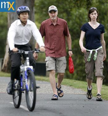
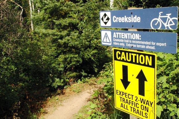
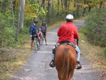
SOCIAL CONFLICT BETWEEN MOTORIZED AND NON-MOTORIZED RECREATIONAL ACTIVITIES.
 SOCIAL CONFLICT BETWEEN MOTORIZED AND NON-MOTORIZED RECREATIONAL ACTIVITIES. There is a great disparity in opinions about the effects on a person s recreational experience when they encounter others on
WASHINGTON STATE PARKS AND RECREATION COMMISSION POLICY/PROCEDURE
 WASHINGTON STATE PARKS AND RECREATION COMMISSION POLICY/PROCEDURE 65-13-1 Use of Other Power-Driven Mobility Devices by Persons with Mobility Disabilities at State Park Facilities See Also: 28 CFR 35 Title
National Recreation Trail Application for Designation
 National Recreation Trail Application for Designation Introduction Thank you for your interest in the National Recreation Trail (NRT) program. Completed NRT application packages must be submitted by December
SLOPE CALCULATION. Wilderness Trekking School 1
 SLOPE CALCULATION By Joe Griffith, February 2014 Objectives Upon completion of this chapter, you will be able to: Read the rise-over-run from a topographic map. Convert the rise-over-run into a slope angle
Hiawatha National Forest St. Ignace Ranger District. File Code: 1950 Date: August 5, 2011
 United States Department of Agriculture Forest Service Hiawatha National Forest St. Ignace Ranger District W1900 West US-2 St. Ignace, MI 49781 906-643-7900 File Code: 1950 Date: August 5, 2011 Dear National
Restore and implement protected status that is equivalent, or better than what was lost during the mid-1990 s
 THE ROSSLAND RANGE, OLD GLORY AREA. Executive summary. The Friends of the Rossland Range Society, on behalf of the local outdoor community, seeks to accomplish the following with respect to the Old Glory
September 14, Comments of the Colorado Trail Foundation On the USFS Scoping Notice of August 13, 2010 RE: the relocation of the CDNST/CT Page 1
 THE COLORADO TRAIL FOUNDATION Comments on the U.S. Forest Service Scoping Notice of August 13, 2010 Regarding the Relocation of THE COLORADO TRAIL AND CONTINENTAL DIVIDE NATIONAL SCENIC TRAIL From La Garita
DRAFT FINAL ACCESSIBILITY GUIDELINES FOR OUTDOOR DEVELOPED AREAS
 Date: October 19, 2009 DRAFT FINAL ACCESSIBILITY GUIDELINES FOR OUTDOOR DEVELOPED AREAS Introduction Background Whom Guidelines Apply To How to Submit Comments Contact for Further Information General Issues:
Table 3-7: Recreation opportunity spectrum class range by prescription. Recreation Opportunity Spectrum (ROS) Classes
 Classes") Appendix F Table -7: Recreation opportunity spectrum class range by prescription. Recreation Opportunity Spectrum (ROS) Classes Prescription Primitive Primitive II Roaded Modified Rural Urban 111 - Primitive
Appendix F Table -7: Recreation opportunity spectrum class range by prescription. Recreation Opportunity Spectrum (ROS) Classes Prescription Primitive Primitive II Roaded Modified Rural Urban 111 - Primitive
Ordinance Number Snowmobiles and ATVs. Replaces pages See also Section County ATV Ordinance.
 Ordinance Number 05-2009 Snowmobiles and ATVs Replaces pages 900-28 - 900-29 See also Section 905.2.2 County ATV Ordinance Amended 02-15-11 ORDINANCE NO. 05-2009 WHEREAS, the use of snowmobiles and All
Table of Contents. page 3 Long term Goals Project Scope Project History. 4 User Groups Defined Trail Representative Committee. 5 Trail Users Breakdown
 Launched April 27th, 2010 1 Table of Contents page 3 Long term Goals Project Scope Project History 4 User Groups Defined Trail Representative Committee 5 Trail Users Breakdown 13 Trail Users Desires 16
ALBANY-HUDSON ELECTRIC TRAIL FEASIBILITY STUDY. Final Report OCTOBER 2011
 ALBANY-HUDSON ELECTRIC TRAIL FEASIBILITY STUDY Final Report OCTOBER 2011 ALBANY-HUDSON ELECTRIC TRAIL FEASIBILITY STUDY Prepared for: Town of East Greenbush 225 Columbia Turnpike Rensselaer, New York 12144
Continental Divide National Scenic Trail Legislative History and Planning Guidance
 Continental Divide National Scenic Trail Legislative History and Planning Guidance Legislation, Policy, and Direction Regarding National Scenic Trails The National Trails System Act, P.L. 90-543, was passed
FACILITY REQUIREMENTS SUMMARY OF KEY ISSUES OVERVIEW
 FACILITY REQUIREMENTS SUMMARY OF KEY ISSUES OVERVIEW This summary is intended to provide a brief overview of the key issues associated with conformance to FAA standards at Methow Valley State Airport.
Recreation Opportunity Spectrum for River Management v
 Recreation Opportunity Spectrum for Management v. 120803 Introduction The following Recreation Opportunity Spectrum (ROS) characterizations and matrices mirror the presentation in the ROS Primer and Field
Trails Technical Committee
 Trails Technical Committee Winter 2017 Draft Report Alignment Proposals for the Inyo National Forest and the Town of Mammoth Lakes Map ID #S18 February 08, 2017 Map ID #S18 Key Agreements As of February
Waukee Trailhead Public Art and Amenities Project
 Waukee - Trailhead Public Art and Amenities Project Sponsor Waukee Project Title Waukee Trailhead Public Art and Amenities Project Termini Description ( i.e. Park Avenue to 19th Street) NE Intersection
Susitna-Watana Hydroelectric Project (FERC No ) Recreation Resources Study Study Plan Section Study Implementation Report
 Recreation Resources Study Study Plan Section Study Implementation Report") (FERC No. 14241) Recreation Resources Study Study Plan Section 12.5 2014 Study Implementation Report Prepared for Prepared by AECOM November 2015 TABLE OF CONTENTS 1. Introduction... 4 2. Study Objectives...
(FERC No. 14241) Recreation Resources Study Study Plan Section 12.5 2014 Study Implementation Report Prepared for Prepared by AECOM November 2015 TABLE OF CONTENTS 1. Introduction... 4 2. Study Objectives...
April 10, Mark Stiles San Juan Public Lands Center Manager 15 Burnett Court Durango, CO Dear Mark,
 Mark Stiles San Juan Public Lands Center Manager 15 Burnett Court Durango, CO 81301 Dear Mark, We are pleased to offer the following comments on the draft San Juan Public Lands Center management plans
BACKCOUNTRY TRAIL FLOOD REHABILITATION PROGRAM
 BACKCOUNTRY TRAIL FLOOD REHABILITATION PROGRAM Backcountry Trail Flood Rehabilitation A June 2013 Flood Recovery Program Summary In June 2013, parts of Southern Alberta were devastated from significant
MiSP Topographic Maps Worksheet #1a SLOPE AND TOPOGRAPHIC CONTOURS
 MiSP Topographic Maps Worksheet #1a Name Date Introduction: SLOPE AND TOPOGRAPHIC CONTOURS Topographic contours are shown by lines of different widths. Each contour is a line of equal elevation; therefore,
Picnic Units A picnic unit is a part of a picnic area
 Grab Bars Grab bars are usually provided in buildings to provide stability and allow a person to use his or her arms to assist in movement over short distances. The most common location for grab bars is
Aspen Skiing Company Policy for Use of Other Power-Driven Mobility Devices And Service Animals
 Aspen Skiing Company Policy for Use of Other Power-Driven Mobility Devices And Service Animals Introduction New rules under the Americans with Disabilities Act (ADA), Titles II and III, went into effect
Appendix 3. Greenway Design Standards. The Whitemarsh Township Greenway Plan
 Appendix 3 Greenway Design Standards This chapter discusses two design standards for the greenway types discussed above. First, trail design standards are presented together with trailhead facilities and
Understanding user expectations And planning for long term sustainability 1
 Understanding user expectations And planning for long term sustainability 1 What is a natural surface trail? It can be as simple has a mineral soil, mulched or graveled pathway, or as developed as elevated
MUNICIPALITY OF ANCHORAGE
 MUNICIPALITY OF ANCHORAGE ANCHORAGE PARKS & RECREATION Memorandum PRC 08-56 DATE: 5 August 2008 TO: FROM: SUBJECT: Parks & Recreation Commission Holly Spoth-Torres, Park Planner PRC 08-56 Far North Bicentennial
CHAPTER 5. Chapter 5 Recreation Element
 CHAPTER 5 Recreation Element Chapter 5 Recreation Element The Recreation Element of the Meyers Area Plan is a supplement to the Recreation Element of the TRPA Regional Plan and the El Dorado County General
RECREATION. Seven issues were identified that pertain to the effects of travel management on outdoor recreation within portions of the project area.
 RECREATION Seven issues were identified that pertain to the effects of travel management on outdoor recreation within portions of the project area. OPPORTUNITIES FOR SOLITUDE / QUIET TRAILS. One attraction
Sawtooth National Forest Fairfield Ranger District
 United States Department of Agriculture Forest Service Sawtooth National Forest Fairfield Ranger District P.O. Box 189 Fairfield, ID. 83327 208-764-3202 Fax: 208-764-3211 File Code: 1950/7700 Date: December
Mt. Hood National Forest
 United States Department of Agriculture Forest Service Mt. Hood National Forest Zigzag Ranger District 70220 E. Highway 26 Zigzag, OR 97049 503-622-3191 Fax: 503-622-5622 File Code: 1950-1 Date: June 29,
MiSP Topographic Maps Worksheet #1a L2
 MiSP Topographic Maps Worksheet #1a L2 Name Date SLOPE AND TOPOGRAPHIC CONTOURS Introduction: Topographic contours are shown by lines of different widths. Each contour is a line of equal elevation; therefore,
Berg Ridge BERG RIDGE 1
 Berg Ridge BERG RIDGE 1 Berg Ridge: $13,650,000 ($75,000 / ERU) Jordanelle Basin Wasatch County, Utah LOCATION: North Central Utah in the Jordanelle Basin of Wasatch County a 45-minute drive from downtown
CATCODE ] CATCODE
![CATCODE ] CATCODE](/thumbs/82/85644630.jpg "CATCODE ] CATCODE") Runways. FAC: 1111 CATCODE: 111111 OPR: AFCEC/COS OCR: AF/A3O-A 1.1. Description. The runway is the paved surface provided for normal aircraft landings and take offs. Runways are classified as either Class
Runways. FAC: 1111 CATCODE: 111111 OPR: AFCEC/COS OCR: AF/A3O-A 1.1. Description. The runway is the paved surface provided for normal aircraft landings and take offs. Runways are classified as either Class
Trail Assessment Report
 Trail Assessment Report Trail Options for the Bear Creek Canyon located in Pikes Peak Ranger District, Pike National Forest and on Colorado Springs Utility Lands Due to the presence of a unique species
13.1 REGIONAL TOURISM ISSUES AND SUMMARY OF FINDINGS
 13 REGIONAL TOURISM T he County of Mariposa s recreation needs and facilities fall within two categories: regional tourism and local recreation. This Element focuses on regional tourism issues related
US Forest Service Bears Ears Trail - NFST 1144 California Park to Hole in Wall Creek. Good (1) 2 3
 2 3") Trail Maintenance Endowment Fund Trail Criteria Form The Trail Maintenance Endowment Fund (TMEF) grant criteria form is used in determining the use of funds available on an annual basis. Decisions on how
Trail Maintenance Endowment Fund Trail Criteria Form The Trail Maintenance Endowment Fund (TMEF) grant criteria form is used in determining the use of funds available on an annual basis. Decisions on how
Proposed Action. Payette National Forest Over-Snow Grooming in Valley, Adams and Idaho Counties. United States Department of Agriculture
 United States Department of Agriculture Forest Service January 2012 Proposed Action Payette National Forest Over-Snow Grooming in Valley, Adams and Idaho Counties Payette National Forest Valley, Adams
2.08 AVALANCHE SEARCH AND RESCUE. Q: What is the process to provide feedback on the Interim Policy and Avalanche Safety Plan?
 2.08.1 RELATED DOCUMENTS 2.08 Avalanche Search and Rescue Policy 2.08 AVALANCHE SEARCH AND RESCUE 2.08.2 FREQUENTLY ASKED QUESTIONS AVALANCHE SAFETY PLANNING Q: Are SAR Groups required to develop their
Port Gamble Shoreline Area Conceptual Trail Proposal
 The North Kitsap Trails Association is pleased to be a partner to the Kitsap Forest and Bay Project and assist Kitsap County, Forterra, Olympic Property Group, Great Peninsula Conservancy and the Port
RECREATION. 1. Conflict between motorized and non-motorized recreation uses,
 Island Unit Trail System Additions Project Chapter 3. Recreation RECREATION INTRODUCTION This section discusses the effects to public recreation opportunities and experiences. The type of recreational
Risk Assessment in Winter Backcountry Travel
 Wilderness and Environmental Medicine, 20, 269 274 (2009) ORIGINAL RESEARCH Risk Assessment in Winter Backcountry Travel Natalie A. Silverton, MD; Scott E. McIntosh, MD; Han S. Kim, PhD, MSPH From the
I. INTRODUCTION EAST COAST GREENWAY STUDY PURPOSE
 I. INTRODUCTION STUDY PURPOSE The purpose of this study is to determine the engineering feasibility of developing the Eastern Trail. It was initiated at the request of the and funded by the Maine Department
ROAD AND TRAIL PROJECT APPROVAL
 ROAD AND TRAIL PROJECT APPROVAL www.marincountyparks.org Marin County Parks, 3501 Civic Center Dr, Suite 260, San Rafael, CA 94903 DATE: July 12, 2017 PRESERVE: Gary Giacomini Open Space Preserve PROJECT:
Peter Axelson. Beneficial Designs, Inc. Minden, NV
 Peter Axelson Beneficial Designs, Inc. Minden, NV Arroya Sit Ski Mono Ski Dynamic Seating Spring Assist Cross Country Ski Hand Bike Adaptive Canoe Seating Available from Chosen Valley Canoe Accessories
Frizzell Creek Ranch Summerville, OR $1,400, ± Acres
 Frizzell Creek Ranch Summerville, OR $1,400,000 165± Acres 1 Introduction The Frizzell Creek Ranch is a beautiful 165± acre ranch located in northeast Oregon at the base of the Wallowa Whitman National
AERONAUTICAL SURVEYS & INSTRUMENT FLIGHT PROCEDURES
 AERONAUTICAL SURVEYS & INSTRUMENT FLIGHT PROCEDURES Current as of November 2012 ALASKA AVIATION SYSTEM PLAN UPDATE Prepared for: State of Alaska Department of Transportation & Public Facilities Division
EXISTING CONDITIONS A. INTRODUCTION. Route 107 Corridor Study Report
 II. EXISTING CONDITIONS A. INTRODUCTION The Route 107 study area extends from the south at Chestnut Street in Lynn approximately 3.7 miles to the north to Boston Street in Salem. The study area has three
Logo Department Name Agency Organization Organization Address Information 5700 North Sabino Canyon Road
 Logo Department Name Agency Organization Organization Address Information United States Forest Coronado National Forest 5700 North Sabino Canyon Road Department of Service Santa Catalina Ranger District
Learning Objectives 7.3 Flight Performance and Planning Flight Planning & Flight Monitoring
 030 00 00 00 FLIGHT PERFORMANCE AND PLANNING 033 00 00 00 FLIGHT PLANNING AND FLIGHT MONITORING 033 01 00 00 FLIGHT PLANNING FOR VFR FLIGHTS Remark Using Training Route Manual VFR charts or CQB Annexes
Preferred Recreation Recommendations Stemilt-Squilchuck Recreation Plan March 2018
 Preferred Recreation Recommendations Stemilt-Squilchuck Recreation Plan March 2018 Below are the recommended recreation ideas and strategies that package together the various recreation concepts compiled
Community Development
 Community Development City & Borough of Juneau Community Development 155 S. Seward Street Juneau, AK 99801 (907) 586 0715 Phone (907) 586 4529 Fax DATE: February 11, 2016 TO: FROM: Planning Commission
DATE: 23 March, 2011 TO: Communities FROM: BlazeSports America. RE: Accessible Trails Checklist 1
 M E M O R A N D U M DATE: 23 March, 2011 TO: Communities FROM: BlazeSports America RE: Accessible Trails Checklist 1 The purpose of the Accessible Trails Checklist (below) is to help the community review
EDGEWILD TRAIL Non Motorized Trail PROPOSED DEVELOPMENT PROJECT
 EDGEWILD TRAIL Non Motorized Trail PROPOSED DEVELOPMENT PROJECT SESW, SWSE Section 15, NWNE, NENW, SWNE, SENE Section 22, Township 138, Range 27 (City of Fifty Lakes) Crow Wing County Land Services Department
Trail Phasing Plan. Note: Trails in the Clear Creek Canyon area (Segments will be finalized in the future to minimize wildlife impacts
 Note: Trails in the Clear Creek Canyon area (Segments 2 5 and a future JCOS connection) will be finalized in the future to minimize wildlife impacts Trail Phasing Plan P Parking 3 Easy Trail Intermediate
LAUNCHING YOUR UNMANNED AIRCRAFT PROGRAM
 LAUNCHING YOUR UNMANNED AIRCRAFT PROGRAM THE DARTDRONES TEAM UNMANNED AIRCRAFT APPLICATIONS AERIAL INSPECTIONS AERIAL INSPECTIONS Safer and faster alternative to visual inspection by an individual Damage
Chambers of Commerce and Lake Groups advertised this NCWRPC created online survey that was : Opened: August 22, 2012; and Closed: October 4, 2012.
 Vilas County Outdoor Recreation Survey Chambers of Commerce and Lake Groups advertised this NCWRPC created online survey that was : Opened: August 22, 202; and Closed: October 4, 202. Q What Vilas County
Green Mountain Trail Collaborative Stewardship and Communication Work Group Meeting Notes June 30, 2010
 Date: 6-30-10 Time: 12:30-1:30 Location: Phone Conference Facilitator: Brian D. Cotterill Note Taker: Brian D. Cotterill Committee Members in Attendance: Danny Hale Doug Webber Sherry Winnie Alexis Nelson
PURPOSE AND NEED. Introduction
 Public Scoping: Allocation of Recreation Capacity for Commercial Outfitter Guide Services on North Kruzof Island Trails (Kruzof Island Outfitter Guide) PURPOSE AND NEED Introduction The U.S. Department
Proposed Architectural Barriers Act Accessibility Guidelines for Outdoor Developed Areas
 Proposed Architectural Barriers Act Accessibility Guidelines for Outdoor Developed Areas Outdoor Developed Areas Homepage Guidelines and Standards Published in the Federal Register on June 20, 2007. PDF
Design Considerations For Accessible Parks & Trails
 Design Considerations For Accessible Parks & Trails Measuring Up: Campbell River 2008 Dave Calver Consulting City of Campbell River Legacies Now: Measuring Up Design Guidelines Design Considerations for
Tahoe National Forest Over-Snow Vehicle Use Designation
 Tahoe National Forest Over-Snow Vehicle Use Designation USDA Forest Service Tahoe National Forest February 20, 2015 Introduction The Forest Service, U.S. Department of Agriculture will prepare an Environmental
2016 Trails Maintenance and Operating Costs
 2016 Trails Maintenance and Operating Costs Motorized Trails Maintenance for motorized trails comes from vehicle registration fees and a portion of the federal Recreation Trails Program (RTP) funds. The
Arctic Husky Lodge Wilderness Adventure
 Arctic Husky Lodge A very comfortable lodge in the far north of Swedish Lapland is the perfect base to enjoy the beauty of winter far inside the Arctic Circle. Activities are available as optional extras
DEPARTMENT: CIVIL ENGINEERING SEMESTER: III SUBJECT CODE / Name: CE2303/ Railway, Airport and Harbors Engineering 2 MARK QUESTIONS AND ANSWERS
 DEPARTMENT: CIVIL ENGINEERING SEMESTER: III SUBJECT CODE / Name: CE2303/ Railway, Airport and Harbors Engineering 2 MARK QUESTIONS AND ANSWERS 1.Define wind Coverage (AUC NOV/DEC 2010),(AUC NOV/DEC 2011)
Rule Governing the Designation and Establishment of All-Terrain Vehicle Use Trails on State Land
 Rule Governing the Designation and Establishment of All-Terrain Vehicle Use Trails on State Land 1.0 Authority 1.1 This rule is promulgated pursuant to 23 V.S.A. 3506. Section 3506 (b)(4) states that an
City of Durango 5.8 FUNDING TRAILS DEVELOPMENT
 5.8 FUNDING TRAILS DEVELOPMENT The City has been successful in establishing dedicated local funding sources as well as applying for grants to develop the City s trail system, having received nearly $2.4
FINAL TESTIMONY 1 COMMITTEE ON RESOURCES UNITED STATES HOUSE OF REPRESENTATIVES. July 13, 2005 CONCERNING. Motorized Recreational Use of Federal Lands
 FINAL TESTIMONY 1 STATEMENT OF DALE BOSWORTH CHIEF Of the FOREST SERVICE UNITED STATES DEPARTMENT OF AGRICULTURE Before the SUBCOMMITTEE ON FORESTS AND FOREST HEALTH And the SUBCOMMITTEE ON NATIONAL PARKS,
NATIONAL PARK SERVICE CERTIFICATION OF COMPLETED SEGMENTS OF THE NORTH COUNTRY NATIONAL SCENIC TRAIL
 NATIONAL PARK SERVICE CERTIFICATION OF COMPLETED SEGMENTS OF THE NORTH COUNTRY NATIONAL SCENIC TRAIL Completed trail segments that (1) follow the route identified in the 1982 National Park Service (NPS)
Kelly Motorized Trails Project Proposed Action
 Kelly Motorized Trails Project Proposed Action November 28, 2011 The Flagstaff Ranger District of the Coconino National Forest is seeking public input on the proposed Kelly Motorized Trails Project (formerly
Runway Roughness Evaluation- Boeing Bump Methodology
 FLIGHT SERVICES Runway Roughness Evaluation- Boeing Bump Methodology Michael Roginski, PE, Principal Engineer Boeing Airport Compatibility Engineering ALACPA XI Seminar, Santiago, Chile September 1-5,
RUSHMORE CONNECTOR TRAIL PROPOSAL
 PURPOSE AND NEED Background The U.S. Forest Service, Black Hills National Forest (Forest Service) has received a special use permit application from the State of South Dakota Department of Game, Fish and
Lincoln County ORP Survey Response Summary
 Lincoln County ORP Survey Response Summary North Central Wisconsin Regional Planning Commission Q1 Which recreational activities did you participate in during 2015? (Choose all that apply.) Answered: 125
American Conservation Experience
 ACE Project Report For Tonto National Forest, Arizona Trail Association and Arizona State Parks Title of Project: 4 Peaks Trail Maintenance Award Contract Number: ASP NM11021 Project Partner: Paul Burghard
Vermont Cows by Peter Salmon
 Vermont Cows by Peter Salmon SUSTAINABLE FOREST & PROPERTY MANAGEMENT: At current the Dorset Town Forest includes the 30 acre parcel that sits atop Owl s Head peak in Dorset. By acquiring this property
GREATER GEELONG PLANNING SCHEME PROPOSED AMENDMENT FOR THE PROTECTION OF EMERGENCY MEDICAL SERVICE HELICOPTER FLIGHTPATHS SERVING GEELONG HOSPITAL
 GREATER GEELONG PLANNING SCHEME PROPOSED AMENDMENT FOR THE PROTECTION OF EMERGENCY MEDICAL SERVICE HELICOPTER FLIGHTPATHS SERVING GEELONG HOSPITAL APRIL 2014 Report Prepared for The Minister for Health
Appendix C AIRPORT LAYOUT PLANS
 Appendix C AIRPORT LAYOUT PLANS Appendix C AIRPORT LAYOUT PLANS Airport Master Plan Santa Barbara Airport As part of this Airport Master Plan, the Federal Aviation Administration (FAA) requires the development
City of Redding Airports
 City of Redding Airports Benton Airpark Redding Municipal Airport DEVELOPMENT AND USE GUIDELINES FOR GENERAL AVIATION HANGARS April 7, 2009 PREFACE The City of Redding, as owner of federally obligated
4.0 OUTDOOR RECREATION 4.1 PUBLIC LANDS
 4.0 OUTDOOR RECREATION 4.1 PUBLIC LANDS Public lands provide a wide range of recreational opportunities and are considered a valuable community asset. There may be seasonal and/or other use restrictions
Marchand Provincial Park. Management Plan
 Marchand Provincial Park Management Plan 2 Marchand Provincial Park Table of Contents 1. Introduction... 3 2. Park History... 3 3. Park Attributes... 4 3.1 Natural... 4 3.2 Recreational... 4 3.3 Additional
S Central Coast Heritage Protection Act APRIL 21, 2016
 STATEMENT OF GLENN CASAMASSA ASSOCIATE DEPUTY CHIEF, NATIONAL FOREST SYSTEM U.S. FOREST SERVICE U.S. DEPARTMENT OF AGRICULTURE BEFORE THE UNITED STATES SENATE COMMITTEE ON ENERGY AND NATURAL RESOURCES
Facilitating Long-Distance Travel On the Ice Age National Scenic Trail. (a.k.a. End-to-End Trail Marking)
") Facilitating Long-Distance Travel On the Ice Age National Scenic Trail 3-15-2000 (a.k.a. End-to-End Trail Marking) More and more people are becoming aware of the outstanding recreation opportunities afforded
Facilitating Long-Distance Travel On the Ice Age National Scenic Trail 3-15-2000 (a.k.a. End-to-End Trail Marking) More and more people are becoming aware of the outstanding recreation opportunities afforded
METROPOLITAN COUNCIL 390 North Robert Street, St. Paul, MN Phone (651) TDD (651)
 TDD (651)") METROPOLITAN COUNCIL 390 North Robert Street, St. Paul, MN 55101 Phone (651) 602 1000 TDD (651) 291 0904 DATE: June 19, 2007 TO: Metropolitan Parks and Open Space Commission FROM: Jan Youngquist, Senior
METROPOLITAN COUNCIL 390 North Robert Street, St. Paul, MN 55101 Phone (651) 602 1000 TDD (651) 291 0904 DATE: June 19, 2007 TO: Metropolitan Parks and Open Space Commission FROM: Jan Youngquist, Senior
THRESHOLD GUIDELINES FOR AVALANCHE SAFETY MEASURES
 BRITISH COLUMBIA MINISTRY OF TRANSPORTATION & INFRASTRUCTURE AVALANCHE & WEATHER PROGRAMS THRESHOLD GUIDELINES FOR AVALANCHE SAFETY MEASURES British Columbia Ministry of Transportation & Infrastructure
St. Joe Travel Management Inventoried Roadless Area Report
 St. Joe Travel Management Inventoried Roadless Area Report Lynette Myhre and Tracy Gravelle July 2015 Regulatory Framework Idaho Roadless Rule Roadless area descriptions from the Idaho Roadless Conservation
Snowmobile Connectors Are Disconnected
 Snowmobile Connectors Are Disconnected By Dave Gibson Adirondack Explorer MONDAY, AUGUST 10, 2015 The Boreas River and Route 28N where DEC proposes a new snowmobile bridge. Photo c Dave Gibson The contradictory,
Department of Agricultural and Resource Economics, Fort Collins, CO
 June 2007 EDR 07-15 Department of Agricultural and Resource Economics, Fort Collins, CO 80523-1172 http://dare.colostate.edu/pubs OF WINE AND WILDLIFE: ASSESSING MARKET POTENTIAL FOR COLORADO AGRITOURISM